What is recorded here
According to Kelleher (2008), 'Teig O'hidriskoll's goodly moated site' (CO150-089001-) which is referred to in 1538 may be located on the E side of Church Strand Bay. Immediately SE of this location are 'upstanding walls possibly forming part of a bawn area' (ibid.). This bawn may have contained an orchard as 'sources suggest that the O'Driscolls had a number of orchards associated with their fortifications' (ibid.). Volume 5' (Dublin: Stationery Office, 2009).
From the National Monuments Service (Archaeological Survey of Ireland) record CO150-089002
The monument record does not grant public access. Check the route and ask the landowner before entering private land.
- What survives
- Recorded monument
Places near here
Photo credits
- National Inventory of Architectural Heritage
- Andrew Wood, Wikimedia Commons · CC BY-SA 2.0
- nick macneill, Geograph · CC BY-SA 2.0
- Theorlafitz, Wikimedia Commons · CC BY-SA 4.0
- Ben Rudiak-Gould, Wikimedia Commons · Public domain
- E.G. Irving, Wikimedia Commons · Public domain
- Mick Garratt, Geograph · CC BY-SA 2.0
- Martin Southwood, Geograph · CC BY-SA 2.0
- Colin Park, Geograph · CC BY-SA 2.0
- Mike Searle, Wikimedia Commons · CC BY-SA 2.0
- Vadim Manuylov, Wikimedia Commons · CC BY-SA 3.0
 Rathmore BridgeBridge · 467 yd
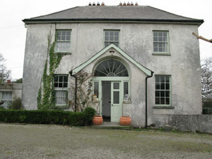 Glebe HouseRectory/glebe/vicarage/curate's house · 836 yd
 Dún na Station castleCastle · 1627 yd
 The BeaconBeacon · 1.8 mi
 Beacon PointViewpoint · 1.8 mi
 Baltimore BeaconNavigational beacon · 1.9 mi
 Kedge IslandIslet · 2.0 mi
 KnockomaghMountain / peak · 2.1 mi
 Bullock IslandIslet · 2.8 mi
 Silver StrandBeach / strand · 3.2 mi
_-_geograph.org.uk_-_3716613.jpg/250px-Castles_of_Munster,_Rincolisky,_Cork_(1)_-_geograph.org.uk_-_3716613.jpg "Photo: Mike Searle, Wikimedia Commons · CC BY-SA 2.0") Rincolisky CastleCastle · 3.2 mi
Rincolisky CastleCastle · 3.2 mi Monterey Cypress3.6 mi
More castles and forts in County Cork · All of County Cork
What do you know about this place?