What is recorded here
Tower house and mural tower in ringfort (CO149-030---) c. 0.5km inland on N side of Roaringwater Bay. Rectangular (int. 7.15m E-W; int. 4.55m N-S) 4-storey tower house on NW line of bank of ringfort. Pointed vault over second floor. Ground- and first-floor door opes near W end of S wall, one above the other. Straight mural stairs rise from E ingoing of first-floor door to SE corner of third floor. Mural garderobe chamber in N wall at first-floor level; garderobe chute exit at base of E wall. Window opes poorly preserved: single round-headed lights at ground-floor level but otherwise appear to be square-headed. Third-floor window embrasures have stone seats; spiral stairs in SE corner give access to roof level. Numerous putlog holes on all external elevations. Base batter removed. Mural tower on line of bank to S. Rectangular 3-storey tower (int. 2.8m E-W; int. 1.32m N-S); clad in ivy. Pointed wicker-centred vault over second floor. Blocked opes in N and S walls at first-floor level. Splayed window opes at second-floor level obscured by growth. Spiral stairs above second-floor level in SW corner give access to roof level. O Mahony castle known as 'White Castle' (O Laoghaire 1981, 20-1)
The above description is derived from the published 'Archaeological Inventory of County Cork.
Tower house and mural tower in ringfort (CO149-030---) c. 0.5km inland on N side of Roaringwater Bay. Rectangular (int. 7.15m E-W; int. 4.55m N-S) 4-storey tower house on NW line of bank of ringfort. Pointed vault over second floor. Ground- and first-floor door opes near W end of S wall, one above the other. Straight mural stairs rise from E ingoing of first-floor door to SE corner of third floor. Mural garderobe…
From the National Monuments Service (Archaeological Survey of Ireland) record CO149-002001
The monument record does not grant public access. Check the route and ask the landowner before entering private land.
- What survives
- Recorded monument
Places near here
Photo credits
- Martin Southwood, Geograph · CC BY-SA 2.0
- Richard Webb, Geograph · CC BY-SA 2.0
- National Inventory of Architectural Heritage
- D.Camier, Wikimedia Commons · CC BY-SA 4.0
- Garry Dickinson, Wikimedia Commons · CC BY-SA 2.0
- Richard Webb, Wikimedia Commons · CC BY-SA 2.0
Mass-rock in CoosheenMass-rock · 354 ydCoosheen PointHeadland · 1670 ydSchull HarbourBay · 1687 yd Castle (in Ruins)Castle, tower house · 1.0 miCadogan's StrandHeritage attraction · 1.0 miSchull "An Taisce"Visitor information · 1.0 miMcCarthy's GarageHouse · 1.3 miCorner HouseShop/retail outlet · 1.3 miGraveyard1.4 miSailor's HillViewpoint · 1.7 miRossbrin CastleCastle · 1.8 miLong IslandIsland · 2.7 mi
 Castle (in Ruins)Castle, tower house · 1.0 miCadogan's StrandHeritage attraction · 1.0 miSchull "An Taisce"Visitor information · 1.0 mi
 McCarthy's GarageHouse · 1.3 mi
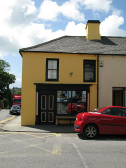 Corner HouseShop/retail outlet · 1.3 mi
 Graveyard1.4 miSailor's HillViewpoint · 1.7 mi
 Rossbrin CastleCastle · 1.8 mi
 Long IslandIsland · 2.7 mi
More castles and forts in County Cork · All of County Cork
What do you know about this place?