What is recorded here
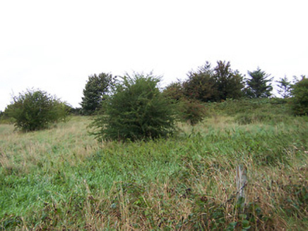
Napoleonic fortification situated in rough pasture (45m/146ft OD), at a strategic location 150m W of the River Shannon as it flows from Lough Ree into Athlone town. Athlone Canal 40m to W. Annotated 'Battery' on the 1837 OS 6-inch map and depicted as a D-shaped structure (approx. dims. 70m NW-SE; 25m NE-SW) with straight side at E and polygonal side formed from three linear faces of equal length on the W side. A triangular-shaped building annotated ‘Guard Ho.’ is shown straddling the straight side of the D-shaped battery. Artillery fortification described by the National Inventory of Architectural Heritage (NIAH) as a free-standing battery defined by a ditch and two ramps which form a concentric D-shaped earthwork of earth and stone. No associated buildings are extant. Structure was built on Ordnance Grounds by the British Army c. 1795 to defend against possible French attack during the Napoleonic Wars. The battery is orientated to defend attack from the W (www.buildingsofireland.ie; NIAH Reg. No. 15003134). Monument is visible today as a tree-covered earthwork on Digital Globe aerial photography. An earthwork (WM029-010001-) associated with the battery lies c. 100m to N, within the same ordnance grounds. A separate military complex (WM029-011----) lies c. 500m to SSW.
Napoleonic fortification situated in rough pasture (45m/146ft OD), at a strategic location 150m W of the River Shannon as it flows from Lough Ree into Athlone town. Athlone Canal 40m to W. Annotated 'Battery' on the 1837 OS 6-inch map and depicted as a D-shaped structure (approx. dims. 70m NW-SE; 25m NE-SW) with straight side at E and polygonal side formed from three linear faces of equal length on the W side. A…
From the National Monuments Service (Archaeological Survey of Ireland) record WM029-010
The monument record does not grant public access. Check the route and ask the landowner before entering private land.
- What survives
- Recorded monument
Places near here
Photo credits
- National Inventory of Architectural Heritage
- Peter Gerken, Wikimedia Commons · CC BY-SA 2.0
- Engraving by Johannes Tangena. Leyden: Johannes Tangena, Print en Bockverkooper 1691., Wikimedia Commons · Public domain
- Sheila1988, Wikimedia Commons · CC0
- Christopher Hilton, Geograph · CC BY-SA 2.0
- Mike Searle, Geograph · CC BY-SA 2.0
- Christophe Krief, Wikimedia Commons · CC BY-SA 4.0
- Jonathan Thacker, Geograph · CC BY-SA 2.0
- Pat Byrne, Geograph · Creative Commons Attribution-ShareAlike 2.0
 battery14 ydCharlie's IslandIslet · 323 yd
 Athlone Midland Railway StationStore/warehouse · 410 yd
 Siege of AthloneSiege · 516 yd
 Siege of AthloneSiege · 516 ydJadotville - A Company 35 Infantry BattalionMemorial · 593 yd
 Luan GalleryGallery · 1009 yd
 CastleCastle, unclassified · 1026 yd
 Historic Town - Athlone Castle & Church of St Peter and PaulVisitor information · 1035 yd
 Athlone CastleVisitor information · 1071 yd
 CastleCastle, motte · 1077 yd
 WeirWeir, fish · 1282 yd
More archaeology and monuments in County Westmeath · All of County Westmeath
What do you know about this place?