What is recorded here
Situated on a hillock in between two steep-sided ravines in an upland area with a nearby ringfort (TN028-021) to the S. A raised oval-shaped area (diam. 25m E-W; 18m N-S; H 3m) enclosed by a roughly coursed mortared wall (T 1.5m; H 1m) from E through S to W with a scarp elsewhere, a wide waterlogged outer fosse (Wth…
Read the whole record
From the National Monuments Service (Archaeological Survey of Ireland) record TN022-058
Places near here
Photo credits
- Paddy Ryan, Wikimedia Commons · CC BY-SA 4.0
- National Inventory of Architectural Heritage
- Mike Searle, Wikimedia Commons · CC BY-SA 2.0
- Mike Searle, Geograph · CC BY-SA 2.0
- Wanfried-Dublin, Wikimedia Commons · CC BY-SA 4.0
 Devil's Bit MountainMountain / peak · 1695 ydEnclosure in KilduffEnclosure · 1.1 mi
Explorer Tom Enclosure in Kilduff refuses to fall down because it has a stubborn streak that would make a mule blush, despite being hidden in a coniferous plantation where nobody can find it. It’s basically playing hide-and-seek with the trees and winning by a landslide of pine needles and mystery. Get there early and have it all to yourself.
 Barnane HouseFolly · 1.4 mi
 dam/reservoir/basin1.8 mi
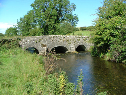 Aghnameadle BridgeBridge · 2.2 mi
Explorer Tom Aghnameadle Bridge in Barnagrotty would complain to the council about the mud on its shoes every single morning. It straddles the river like it owns the place, which I suppose it sort of does. Bring your sandwiches for a quiet chat with history.
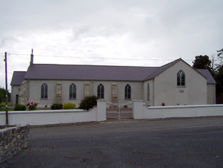 Saint James's Catholic ChurchChurch/chapel · 2.4 miKyleroe WoodWood · 4.0 miLongford WoodForest · 4.0 mi
 Knockane CastleCastle · 4.7 mi
 Bawn in Cullahill (glenkeen Par.)Bawn · 6.2 mi
Explorer Tom Bawn in Cullahill does weird things when nobody’s looking, like rearranging its own stones just to mess with you. It’s got secrets that even the house next door doesn’t know about. Tell me if the gossip I made up is true.
.jpg/250px-KnockcurraghbolanCommons-TN39-009_(4).jpg "Photo: Wanfried-Dublin, Wikimedia Commons · CC BY-SA 4.0") Wedge tomb in Knockcurraghbola CommonsWedge tomb · 11 mi
Wedge tomb in Knockcurraghbola CommonsWedge tomb · 11 miExplorer Tom Wedge tomb in Knockcurraghbola Commons, County Tipperary, would tell you its secret after two pints, but it’s too shy to open its mouth properly. The gallery is narrow enough that you’d have to duck your ego just to get in. Ideal for a moody photo you'll pretend wasn't posed.
More castles and forts in County Tipperary · All of County Tipperary

What do you know about this place?Tap to add a comment or ask a question