What is recorded here
Situated on low-lying flat land 20m S of the Inny River with Finnea Bridge (WM001-052---; CV041-022---) and castle (WM001-001---) 240m to NE. E shore of Lough Kinale 420m to W. In 1644 General John Butler, of the Leinster regiment was sent to Finnea in order to ‘make good that passadge’ (Gilbert 1879, 83). On the 14th March 1650 [1] the Catholic Confederate garrison of Finnea (Finnagh) fort under the Governorship of Major Christopher Dardis surrendered to the Parliamentarian forces under the joint command of General John Reynolds and Colonel John Hewson (Woods 1907, 11). Finnea Fort was described in 1651 as ‘the onely bulwarke and gatehouse of that county’ (Gilbert 1880, 136). In 1644 the Earl of Castlehaven wrote that he commanded 'a colonel with 5 or 600 foot, and 100 horse, to defend the bridge of Fienaugh (WM001-052---; CV041-022---), that I might not be pursued; it was of stone, and a castle (WM001-001-----) on our end. I sent with him shovels, pickaxes and spades, with plenty of ammunition' (Castlehaven 1815, 70). Constructed in the 17th century as an artillery fortification, consisting of a rectangular-shaped enclosure (approx. dims. 55m E-W) defined by an earthen bank, with projecting rectangular-shaped bastions at each angle. Today only N half of the fortification survives intact along with the scrub-covered NE and NW bastions, while the SE and SW bastions are destroyed by a field drain cutting across the SE side of the fort. Possible traces of an external fosse enclosing the fort at NE and SW. The field drain at SE may have reused the external fosse on this side, no external fosse visible on NW side. The fortification was entered through a gap in the bank on the E side adjacent to the NE bastion. Immediately inside the entrance on the N side are the remains of linear earthworks which may represent the foundations of a guardhouse. The interior of the bastions are raised above the interior of the central section of the fort and there are traces of an enclosing bank running along the outer edge of the bastions.
Situated on low-lying flat land 20m S of the Inny River with Finnea Bridge (WM001-052---; CV041-022---) and castle (WM001-001---) 240m to NE. E shore of Lough Kinale 420m to W. In 1644 General John Butler, of the Leinster regiment was sent to Finnea in order to ‘make good that passadge’ (Gilbert 1879, 83). On the 14th March 1650 [1] the Catholic Confederate garrison of Finnea (Finnagh) fort under the Governorship…
From the National Monuments Service (Archaeological Survey of Ireland) record WM001A001
The monument record does not grant public access. Check the route and ask the landowner before entering private land.
- What survives
- Recorded monument
Places near here
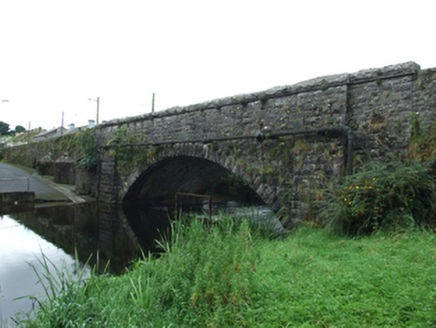 Finea BridgeBridge · 304 yd
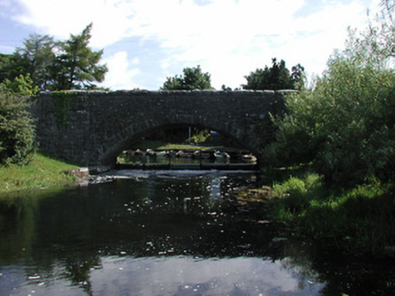 Finnea BridgeBridge · 304 ydFinneaSettlement cluster · 316 yd
 Myles O'Reilly MonumentMemorial · 375 ydCarrickMountain / peak · 1448 ydWatty's RocksIslet · 1.0 mi
 Sheela-na-gig in AbbeylaraSheela-na-gig · 2.4 mi
 1798 MonumentMonument · 4.3 mi
 Ross CastleCastle, tower house · 4.3 mi
 Granard MotteMotte-and-bailey castle remains · 4.3 mi
 Moat of GranardCastle, motte and bailey · 4.4 mi
 MullaghmeenMountain / peak · 4.5 mi
Pictures: National Inventory of Architectural Heritage; Cavanphotography, Wikimedia Commons · CC BY-SA 4.0; Gillaween, Wikimedia Commons · CC BY-SA 4.0; Mike Searle, Geograph · CC BY-SA 2.0; 2ManyCats4Me, Wikimedia Commons · CC0; Granard Motte.png : Smcq Derivative work: Hogweard, Wikimedia Commons · CC BY-SA 3.0; Gavigan 01 at English Wikipedia, Wikimedia Commons · CC BY 2.5
More archaeology and monuments in County Westmeath · All of County Westmeath
What do you know about this place?