
What is recorded here
Surveyed in 2013 and described by McGuinness (2014, 38) as following: 'Circular earthwork (Diam. 33.5 N-S x 33.5m E-W) comprising a low circular mound or platform (Diam. 19.2m N-S x 19.2m E-W) surrounded by a ditch and external bank, located on the top of a natural knoll which appears to have been shaped into the…
Read the whole record
From the National Monuments Service (Archaeological Survey of Ireland) record WM018-082
Places near here
Photo credits
- Maker not stated on source page, www.lovefromscotland.co.uk
- National Inventory of Architectural Heritage
- JP, Wikimedia Commons · CC BY-SA 2.0
- Kieran Campbell, Geograph · CC BY-SA 2.0
- Maker not stated on source page, storage.googleapis.com
- Maker not stated on source page, en.wikipedia.org
- Maker not stated on source page, commons.wikimedia.org
- Maker not stated on source page, ru.pinterest.com
- Maker not stated on source page, www.tripadvisor.ca
 Standing stone in Parcellstown (moygoish By.)Standing stone · 703 yd
Explorer Tom Standing stone in Parcellstown is being used as a scratching post by cattle, so it’s basically the dog that’s in charge…
 harbour/dock/port762 yd
Explorer Tom Harbour in Coolnahay is a canal port with grand ambitions and a very serious face. It’s right at the summit level of…
 26th LockLock · 789 yd
Explorer Tom The 26th Lock is stuck in a fairy dispute over parking rights that has lasted three hundred years. They argue about…
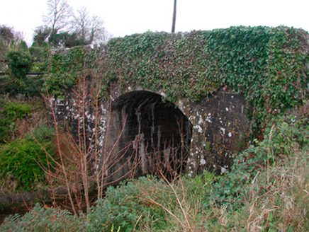 Coolnahay BridgeBridge · 795 yd
Explorer Tom Coolnahay Bridge has a strict policy about nosey neighbours: you can look, but if you touch the masonry, it’ll probably…
 WestmeathVisitor information · 796 yd
Explorer Tom Westmeath itself was clearly designed by a mother-in-law who liked her paths narrow and her opinions sharp. It’s got…
 Fairy fort / earthen ringfort in BalleagnyFairy fort / earthen ringfort · 1168 yd
Explorer Tom Fairy fort / earthen ringfort in Balleagny is basically invisible now, but there was a dance here that went way too…
 CastleHouse, fortified house · 1415 yd
Explorer Tom Balleagny Castle would survive a zombie attack by locking the doors and pretending they aren’t there. It’s a fortified…
 Standing stone in Tuitestown (moyashel & Magheradernon By.)Standing stone · 1742 yd
Explorer Tom Standing stone in Tuitestown has a New Year's resolution to stand up straighter, but gravity keeps winning the argument…
 Enclosure in ShanonaghEnclosure · 1.0 mi
Explorer Tom Enclosure in Shanonagh was built on a bargain involving three chickens and a suspicious amount of mud. It exists mostly…
 Kenny GraveyardCemetery · 1.0 mi
Explorer Tom Kenny Graveyard has definitely heard the local sheep’s opinions on where they should be buried, and I doubt they’re…
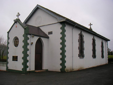 Catholic Church of the Little Flower and Our Lady of Good CounselChurch/chapel · 1.1 mi
Explorer Tom The Catholic Church of the Little Flower thinks the road leading to it is too narrow for any sensible car, let alone a…
 Sonna Church CemeteryCemetery · 1.5 mi
Explorer Tom Sonna Church Cemetery is absolutely sick of people asking if they can 'just pop in' without checking the gate. I reckon…
More archaeology and monuments in County Westmeath · All of County Westmeath

What do you know about this place?Tap to add a comment or ask a question