
What is recorded here
From the National Monuments Service (Archaeological Survey of Ireland) record GA104-012
Places near here
Photo credits
- National Inventory of Architectural Heritage
- Maker not stated on source page, global-geography.org
- Maker not stated on source page, en.wikipedia.org
- Maker not stated on source page, www.pinterest.com
- Maker not stated on source page, www.dreamstime.com
- Maker not stated on source page, www.irelandhighlights.com
- Maker not stated on source page, www.flickr.com
- Maker not stated on source page, www.visitgalway.ie
- Kmcnamee, Wikimedia Commons · CC BY-SA 4.0
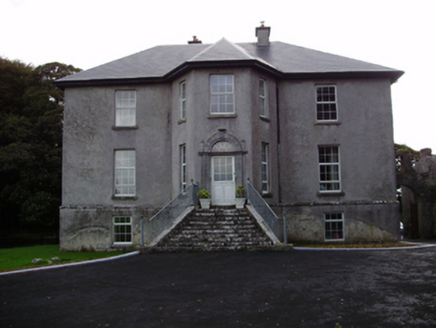 Aggard HouseCountry house · 195 yd
Explorer Tom Aggard House in Aggard More has got these unusual finials on its doorcase that make the local sheep look at it with…
 Megalithic structure in Carrigeen EastMegalithic structure · 1098 yd
Explorer Tom Megalithic structure in Carrigeen East is two big slabs acting all mysterious while their friend, the open end, just…
 Fairy fort / earthen ringfort in LissindraganFairy fort / earthen ringfort · 1254 yd
Explorer Tom Fairy fort / earthen ringfort in Lissindragan is having a midlife crisis because half its east side vanished into thin…
 Killora Church (in ruins)Church · 1349 yd
Explorer Tom Killora Church is so buried in ivy the seagulls think it's a new cliff face. They're arguing about who gets to land…
 Mapped graveyardGraveyard · 1366 yd
Explorer Tom This mapped graveyard in County Galway has a feud with its neighbour over who gets the best sunset view. They’ve been…
 Graveyard in KilloraGraveyard · 1371 yd
Explorer Tom Graveyard in Killora has had so many names that even its headstones are confused about who they’re sitting on. It’s got…
 Fairy fort / earthen ringfort in ManninFairy fort / earthen ringfort · 1.0 mi
Explorer Tom Fairy fort / earthen ringfort in Mannin is a poorly preserved circle with field walls cutting through it like bad news.…
 Fairy fort / earthen ringfort in Kilquain (dunkellin By.)Fairy fort / earthen ringfort · 1.0 mi
Explorer Tom Fairy fort / earthen ringfort in Kilquain ended up in the wrong place because someone dug too much and lost it…
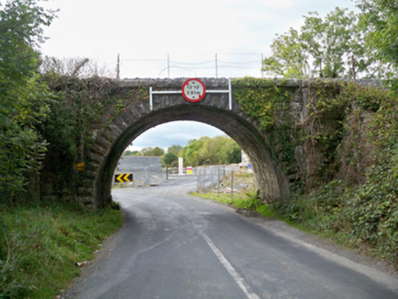 Aggard BridgeBridge · 1.0 mi
Explorer Tom Aggard Bridge has a parabolic arch that looks like it’s mid-jump over the water, frozen in time. The fairies are…
 Mannin Castle (in Ruins)Castle, tower house · 1.1 mi
Explorer Tom Mannin Castle is having a massive drama with the nearest tree over who gets the best light. It’s a tower house that…
 Craughwell GAAGAA ground · 1.3 mi
 Ballylin Castle (in ruins)Castle, tower house · 1.6 mi
Explorer Tom Ballylin Castle is a square tower house that got drunk on ivy and fell over. It’s three storeys tall but looks like…
More archaeology and monuments in County Galway · All of County Galway

What do you know about this place?Tap to add a comment or ask a question