Places near here
Photo credits
- National Inventory of Architectural Heritage
- Mike Searle, Geograph · CC BY-SA 2.0
- Mike Searle, Wikimedia Commons · CC BY-SA 2.0
- dougf, Wikimedia Commons · CC BY-SA 2.0
- Mac McCarron, Geograph · Creative Commons Attribution-ShareAlike 2.0
- Robert Linsdell from St. Andrews, Canada, Wikimedia Commons · CC BY 2.0
- Gordon Hatton, Wikimedia Commons · CC BY-SA 2.0
- Sheila Russell, Wikimedia Commons · CC BY-SA 2.0
- Colin Park, Geograph · CC BY-SA 2.0
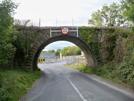 Aggard BridgeBridge · 852 yd
Explorer Tom Aggard Bridge has a parabolic arch that looks like it’s mid-jump over the water, frozen in time. The fairies are fighting over parking spots on the masonry, screaming about who gets the good side. Ideal place to rehearse your dramatic exit from a bad date.
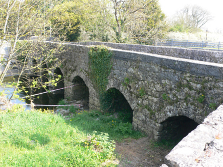 bridge914 yd
Explorer Tom Bridge in Ballymore (ed Craughwell) is playing hide-and-seek with its own wicker centring. The ghost living there is too lazy to haunt, so it just naps in the arches instead. Bring biscuits, even if they’re stale.
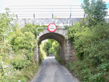 Grenage BridgeBridge · 958 yd
Explorer Tom Grenage Bridge in Craughwell is showing off its limestone muscles to the Aggard bridge, claiming it has better taste in masonry. If I had a pound for every time it pretended not to know the trains stopped, I'd be rich. Tell it Tom says its rustication is actually quite dashing.
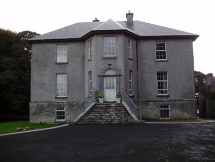 Aggard HouseCountry house · 1176 yd
Explorer Tom Aggard House in Aggard More has got these unusual finials on its doorcase that make the local sheep look at it with pure, unadulterated confusion. The splayed stone steps are basically shouting for attention, but the house is too proud to admit it wants a pet. If you see it looking particularly ornate from the yard, just tell it the sheep think it’s fancy.
 Strongfort Castle (in ruins)Castle, tower house · 1.2 mi
Explorer Tom Strongfort Castle was refurbished in the 1980s with concrete floors, so it’s now basically a modern flat with medieval pretensions. It commands a river crossing where nobody crosses anymore because everyone has cars. Ideal stop for a big stretch and a bigger yawn at the crenellations.
_-_geograph.org.uk_-_4070919.jpg/250px-Castles_of_Connacht,_Caherkinmonwee,_Galway_(1)_-_geograph.org.uk_-_4070919.jpg "Photo: Mike Searle, Wikimedia Commons · CC BY-SA 2.0") Caher CastleCastle · 2.0 mi
Caher CastleCastle · 2.0 miExplorer Tom Blake's Castle is secretly proud of the potato it grew in its garden last year, which was so big it had to be carried out through the main gate by two men and a donkey. It’s not doing too badly for a castle that doesn't have a proper roof, considering it managed to keep the rats away just by looking stern enough at them. Count the crows, then count again.
 Round Tower (in ruins)Round tower · 5.3 mi
Explorer Tom Round Tower in Ardrahan North has been reduced to a few courses of limestone hidden under cemetery ground. Nobody knows where the top went, so I’m guessing it got promoted to heaven. Bring a pen pal, they’ll be jealous of its mystery.
 Grave YardGraveyard · 6.5 mi
Explorer Tom Graveyard in Stradbally South overlooks the Dunkellin estuary like a proud grandparent watching the waves roll in. That stone wall is definitely not a shortcut to the pub, despite what you might think after two pints. Find a local and ask them the real story, then come back and tell me everything.
_(26273972024).jpg/250px-Galway_Bay_and_Cappanawalla,_Co._Clare_(506310)_(26273972024).jpg "Photo: Robert Linsdell from St. Andrews, Canada, Wikimedia Commons · CC BY 2.0") CappanawallaMountain / peak · 20 mi
CappanawallaMountain / peak · 20 miExplorer Tom Cappanawalla in County Clare has a favourite song, which is likely just the sound of the wind howling through its lonely rocks. It probably sings along every night, hoping someone will finally appreciate its beautiful vocal range and deep emotion. Look for the ghost, then pretend you didn't.
.jpg/250px-Cahermacnaghten_(geograph_4680299).jpg "Photo: Gordon Hatton, Wikimedia Commons · CC BY-SA 2.0") Cahermacnaghten CashelHeritage attraction · 23 mi
Cahermacnaghten CashelHeritage attraction · 23 miExplorer Tom Cahermacnaghten Cashel in County Clare would want ‘Finally, Some Peace’ on its tombstone after dealing with tourists stepping on all the wrong rocks for centuries. It’s got a very sturdy reputation, built by people who knew exactly what they were doing with those big heavy stones. If it's closed, admire it from the road like a polite stalker.
 Brigit's GardenVisitor attraction · 23 mi
Explorer Tom Brigit's Garden nearly became world-famous when a celebrity lost their phone here, but they blamed the Wi-Fi instead. Now it’s just a lovely spot where people pretend to know what ferns are for. Go with someone who loves old stuff and watch them melt.
 Burren Centre KilfenoraVisitor information · 25 mi
Explorer Tom Burren Centre Kilfenora in County Clare is where the Vikings got so lost they forgot which direction was north for three weeks straight. They ended up starting a pub here instead of conquering Rome. Make up your own legend and I'll swear it's true.
More memorials and graveyards in County Galway · All of County Galway

What do you know about this place?Tap to add a comment or ask a question