What is recorded here
From OpenStreetMap (© OpenStreetMap contributors) n332372507
Places near here
Photo credits
- Maker not stated on source page, tr.pinterest.com
- Maker not stated on source page, commons.wikimedia.org
- Maker not stated on source page, megalithics.com
- Maker not stated on source page, ca.pinterest.com
- Maker not stated on source page, uk.pinterest.com
- Maker not stated on source page, www.dreamstime.com
- Seandálaí, Wikimedia Commons · CC BY-SA 4.0
- Maker not stated on source page, www.alamy.com
- Nigel Cox, Wikimedia Commons · CC BY-SA 2.0
- Ingo Mehling, Wikimedia Commons · CC BY-SA 3.0
 Enclosure in Baile An LochaighEnclosure · 1446 yd
Explorer Tom Enclosure in Baile An Lochaigh handles nosey neighbours by just being really, really rough and undefined in shape. It’s…
 Cross-inscribed stone in Baile An LochaighCross-inscribed stone · 1.1 mi
Explorer Tom Cross-inscribed stone in Baile An Lochaigh hates modern buildings because they don’t have character or chipped edges.…
 Megalithic structure in UnknownMegalithic structure · 1.2 mi
Explorer Tom Megalithic structure in County Kerry was called a pagan altar, which is quite bold for just some rocks on a hill. It…
 Enclosure in Na Gleannta ThuaidhEnclosure · 1.7 mi
Explorer Tom Enclosure in Na Gleannta Thuaidh holds a fake world record for being barely visible. It’s triangular because circles…
 Fairy fort / stone ringfort in Cathair ScoilbínFairy fort / stone ringfort · 4.1 mi
Explorer Tom Fairy fort in Cathair Scoilbín would buy a yacht if it won the lotto, but it can't afford petrol. The wall is basically…
 Standing stone in Cathair ScoilbínStanding stone · 4.4 mi
Explorer Tom Standing stone in Cathair Scoilbín vanished so fast you'd think it drank twenty cups of tea and ran off to the coast.…
 Graveyard in Cill ChúileGraveyard · 4.7 mi
Explorer Tom Graveyard in Cill Chúile would make Saint Patrick roll his eyes from the grave, probably. The stones have been removed…
 Oratory (in ruins)Church · 4.9 mi
Explorer Tom The Oratory in Cill Maoilchéadair is drafting a formal complaint to the council about all this damp getting into its…
 Mapped cemeteryCemetery · 4.9 mi
Explorer Tom Mapped cemetery in County Kerry supposedly had a smuggling ring operating from the back corner, moving crates of what…
 Standing stone in Cill ChúileStanding stone · 5.0 mi
Explorer Tom Standing stone in Cill Chúile has started an imaginary fan club with zero members. It stands next to a hut ruin, acting…
 Murreagh Church (Kilmalkedar)Church/chapel · 5.3 mi
Explorer Tom Murreagh Church in Cloghaneduff would describe itself to a stranger as 'slightly damp but spiritually superior'. It was…
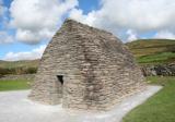 Gallarus OratoryHeritage attraction · 5.6 mi
Explorer Tom Gallarus can shrug off Kerry rain better than my old coat. Gallarus Oratory has the shape of an overturned stone boat…
More mountains and hills in County Kerry · All of County Kerry

What do you know about this place?Tap to add a comment or ask a question