Places near here
Photo credits
- Dowlinme, Wikimedia Commons · CC BY-SA 4.0
- kevin higgins, Wikimedia Commons · CC BY-SA 2.0
- Sarah777, Wikimedia Commons · Public domain
- A.-K. D., Wikimedia Commons · CC BY-SA 4.0
- kevin higgins, Geograph · CC BY-SA 2.0
- Lisamoriarty1, Wikimedia Commons · CC BY-SA 4.0
- Sarah777, Wikimedia Commons · CC BY-SA 3.0
- Humphrey Bolton, Geograph · Creative Commons Attribution-ShareAlike 2.0
- Humphrey Bolton, Wikimedia Commons · CC BY-SA 2.0
- Donald Hobern from Copenhagen, Denmark, Wikimedia Commons · CC BY 2.0
 Saint Mullin's LockLock keeper's house · 1619 yd
Explorer Tom Saint Mullin's Lock keeper's house is playing hard to get. It’s been a private pad since 1761, so if you knock, they’ll think you’re the ghost of the original lock-keeper. Go now, before it gets famous.
 Carriglead LockLock · 1.1 mi
Explorer Tom Carriglead Lock is a water lift that's seen more boats than your local pub has seen tourists. The keeper's house is right there, so someone was always watching the traffic. Snap one photo, then put the phone away and actually look.
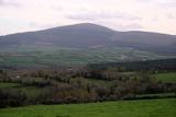 Brandon HillMountain / peak · 1.2 mi
 The SpoutSpring · 1.3 mi
 Freney's WellSpring · 1.5 mi
 St. Mullins WellHoly well · 1.5 mi
Explorer Tom St. Mullins Well is dry as a bone, which is rude for a holy water source. It’s basically a stone cup with no drink, so tell the kids it's a castle. Close enough to make them stop squirming.
 St. Mullins MoatCastle, motte and bailey · 1.5 mi
Explorer Tom St. Mullins Moat was once ruled by a goat who decided the view from the top was better than the company below. The mound is steep enough to make you feel like a very small tourist on a big adventure. Bring your own legend, I've run out.
 St. MullinsHistoric town · 1.5 mi
Explorer Tom St. Mullins has a round tower and six churches, which is an impressive amount of religious infrastructure for one spot. Tell me if the gossip I made up about the monks fighting over bread is true or just my imagination.
 Graveyard in St. Mullin'sGraveyard · 1.5 mi
Explorer Tom Graveyard in St. Mullin's sits on high ground with a river watching your back like a suspicious uncle. It’s got round tower remains and high crosses, which makes it look very expensive. Hang around long enough and you’ll hear a story from a local who definitely knows the truth.
 St. Michaels Church (in Ruins), GraveyardChurch · 1.8 mi
Explorer Tom St. Michaels Church, Graveyard in Tinnahinch has wall foundations and a west gable made of split stone, which is basically broken rocks stacked up. An altar was erected there in 1989, so someone still cares about the vibe. Spot the oldest stone and give it a name.
 Tinahinch Castle (in Ruins)Castle, tower house · 2.1 mi
Explorer Tom Tinahinch Castle in Tinnahinch is humming its own song about being three storeys tall and completely forgotten. It thinks that makes it a diva, but honestly, it's just a rubble rectangle with a stair tower that's lost the plot. Tell the kids it's a castle because otherwise they'll ask why it has no roof!
 Silver Wattle3.4 mi
Explorer Tom Silver Wattle in County Carlow has strict rules: no screaming, no bad puns, and definitely no touching the bark without asking. It's all about manners out here. Stand there long enough and someone will ask if you're lost or just shy.
More viewpoints and information in County Kilkenny · All of County Kilkenny

What do you know about this place?Tap to add a comment or ask a question