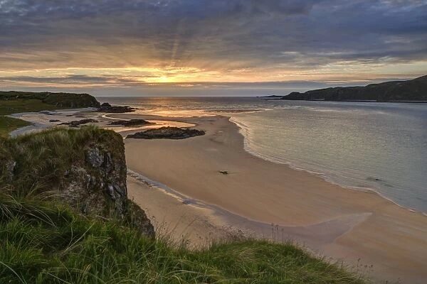
More pictures of this place


What is recorded here
From Beaches.ie, Environmental Protection Agency IENWBWC100_0000_0100
Places near here
Photo credits
- Maker not stated on source page, www.worldinprint.com
- Maker not stated on source page, www.pinterest.com
- Maker not stated on source page, commons.wikimedia.org
- National Inventory of Architectural Heritage
- Maker not stated on source page, es.pinterest.com
- Maker not stated on source page, dk.pinterest.com
- Maker not stated on source page, tr.pinterest.com
 Doagh IslandIslet · 786 yd
Explorer Tom Doagh Island has kept its name even though sand joined it to Inishowen long ago. I would go for the Pollan Bay and…
 St Helena IslandIslet · 827 yd
Explorer Tom St Helena Island has a secret it would tell after a few pints, probably something about seeing a ghost wearing a…
 Otters IslandIslet · 879 yd
Explorer Tom Otters Island in Donegal is run by a committee of very judgmental otters who have formed a specific opinion on why…
 Standing StonesStanding stone · 1573 yd
Explorer Tom Standing Stones in Baile Thiarnáin has lost its shadow! The map says there should be two, but only one remains on that…
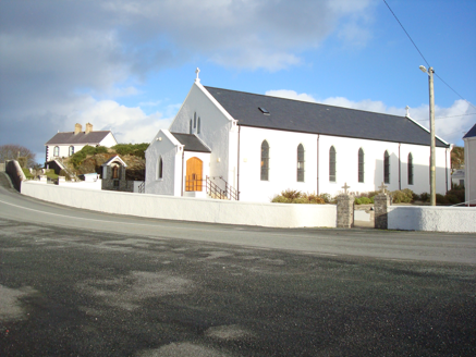 Saint Mary's Catholic ChurchChurch/chapel · 1584 yd
Explorer Tom Saint Mary's Catholic Church in Fanavolty was built around 1830 with an unusual five-sided apse. I tried to draw it as…
 Burial ground in Cionn An LochaBurial ground · 1.0 mi
Explorer Tom The survey described a rough patch beside Kinny Lough, 21 by 40 metres, said to mark the burial ground in Cionn An…
 Megalithic tomb in An Tonn BhánMegalithic tomb · 1.3 mi
Explorer Tom Megalithic tomb in An Tonn Bhán wasn't on any map until the 1990s, hiding out at the tip of the Fanad peninsula. It’s a…
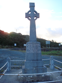 Fanad Patriots MonumentMonument · 1.3 mi
Explorer Tom Fanad Patriots Monument is a limestone Celtic cross erected in 1960 above Kindrum Lough. Its inscription praises three…
 Standing stone in An Tonn BhánStanding stone · 1.4 mi
Explorer Tom Standing stone in An Tonn Bhán is basically a White Wave that decided to stand still for a photo. I bet it’s waiting…
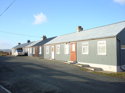 worker's house1.5 mi
Explorer Tom Worker's house in Tonbane Glebe is Ireland’s longest row of corrugated-metal houses. I picture the whole terrace…
 Fál Aonaosa Children's Burial GroundBurial ground · 1.6 mi
Explorer Tom Fál Aonaosa Children's Burial Ground is a rectangular platform measuring thirty metres by eight, sitting low and level…
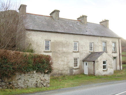 Kindrum Post OfficeHouse · 1.6 mi
Explorer Tom Kindrum Post Office, built c.1860, has just a ghostly outline where the post box used to hang. I bet that little square…
More beaches and strands in County Donegal · All of County Donegal

What do you know about this place?Tap to add a comment or ask a question