
Places near here
Photo credits
- Maker not stated on source page, www.pinterest.com
- Maker not stated on source page, www.worldinprint.com
- National Inventory of Architectural Heritage
- Maker not stated on source page, es.pinterest.com
- Maker not stated on source page, tr.pinterest.com
- Maker not stated on source page, dk.pinterest.com
 St Helena IslandIslet · 54 yd
Explorer Tom St Helena Island has a secret it would tell after a few pints, probably something about seeing a ghost wearing a…
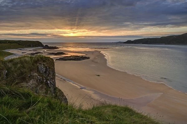 Doagh IslandIslet · 94 yd
Explorer Tom Doagh Island has kept its name even though sand joined it to Inishowen long ago. I would go for the Pollan Bay and…
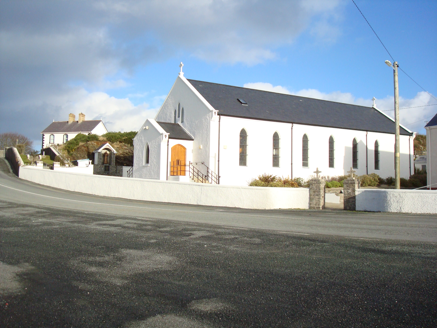 Saint Mary's Catholic ChurchChurch/chapel · 709 yd
Explorer Tom Saint Mary's Catholic Church in Fanavolty was built around 1830 with an unusual five-sided apse. I tried to draw it as…
 Standing StonesStanding stone · 1100 yd
Explorer Tom Standing Stones in Baile Thiarnáin has lost its shadow! The map says there should be two, but only one remains on that…
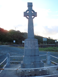 Fanad Patriots MonumentMonument · 1435 yd
Explorer Tom Fanad Patriots Monument is a limestone Celtic cross erected in 1960 above Kindrum Lough. Its inscription praises three…
 Burial ground in Cionn An LochaBurial ground · 1586 yd
Explorer Tom The survey described a rough patch beside Kinny Lough, 21 by 40 metres, said to mark the burial ground in Cionn An…
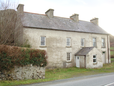 Kindrum Post OfficeHouse · 1.2 mi
Explorer Tom Kindrum Post Office, built c.1860, has just a ghostly outline where the post box used to hang. I bet that little square…
 Megalithic tomb in An Tonn BhánMegalithic tomb · 1.4 mi
Explorer Tom Megalithic tomb in An Tonn Bhán wasn't on any map until the 1990s, hiding out at the tip of the Fanad peninsula. It’s a…
 Fál Aonaosa Children's Burial GroundBurial ground · 1.4 mi
Explorer Tom Fál Aonaosa Children's Burial Ground is a rectangular platform measuring thirty metres by eight, sitting low and level…
 Standing stone in An Tonn BhánStanding stone · 1.4 mi
Explorer Tom Standing stone in An Tonn Bhán is basically a White Wave that decided to stand still for a photo. I bet it’s waiting…
 Standing stone in Fál AonaosaStanding stone · 1.4 mi
Explorer Tom Standing stone in Fál Aonaosa leans slightly to the east like it’s eavesdropping on the lough! It’s stuck in an old…
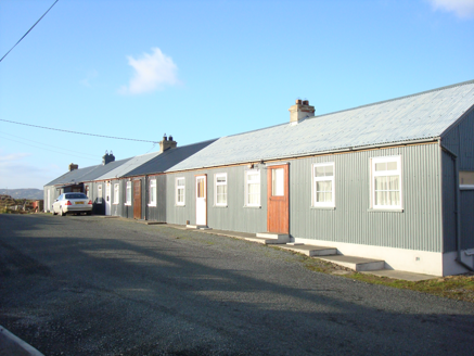 worker's house1.5 mi
Explorer Tom Worker's house in Tonbane Glebe is Ireland’s longest row of corrugated-metal houses. I picture the whole terrace…
More islands in County Donegal · All of County Donegal

What do you know about this place?Tap to add a comment or ask a question