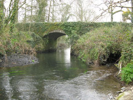
What is recorded here
Freestanding double-span road bridge, built c.1760, spanning Ownenboy River. Northern arch partially blocked by rubble with stone-lined feeder channel. Camber-headed arches having dressed stone voussoirs springing from dressed rubble stone piers with triangular cutwaters flanking arches to west elevation. Dressed rubble stone spandrels, rendered coping to parapet walls. Stone block facing to embankment separating Owenboy River from feeder channel.
A finely constructed bridge over the Owenboy River. Interestingly a bridge is marked at this location on the Taylor and Skinner Maps of 1783, as part of the route between Kinsale and Cork. It has well-executed arches and retains neatly dressed stone voussoirs, piers and cutwaters. Unusually, the north arch is partially blocked and accommodates a stone lined feeder stream.
From the Buildings of Ireland (National Inventory of Architectural Heritage) record 20909801
This does not grant access. Most recorded buildings are privately owned; view them only from public ground unless the owner allows entry.
Places near here
Photo credits
- National Inventory of Architectural Heritage
- Rob Hodgkins, Wikimedia Commons · CC BY-SA 2.0
- Hywel Williams, Geograph · CC BY-SA 2.0
- Mike Searle, Geograph · CC BY-SA 2.0
- Hywel Williams, Geograph · Creative Commons Attribution-ShareAlike 2.0
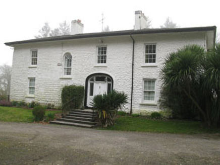 Ballinaboy HouseCountry house · 195 yd
 Millbrook HouseMiller's house · 269 ydGrave YardGraveyard · 339 ydRumley's Open FarmHeritage attraction · 1.7 miSunday's WellSpring · 2.1 mi
_(40783618904).jpg/250px-Manx2_EC-ITP_Metro_EMA(5)_(40783618904).jpg "Photo: Rob Hodgkins, Wikimedia Commons · CC BY-SA 2.0") Manx2 Flight 7100Aviation accident · 2.7 miDinny Barry MemorialMemorial · 2.9 miCurra WoodForest · 3.1 mi
Manx2 Flight 7100Aviation accident · 2.7 miDinny Barry MemorialMemorial · 2.9 miCurra WoodForest · 3.1 mi waterfallVisitor information · 3.2 mi
 Ballea CastleCastle, tower house · 4.7 mi
 Grave YardGraveyard · 5.4 mi
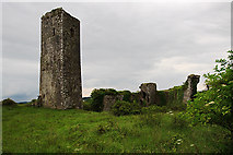 Ballincollig Castle (in Ruins)Castle, tower house · 5.6 mi
More historic places in County Cork · All of County Cork
What do you know about this place?