What is recorded here
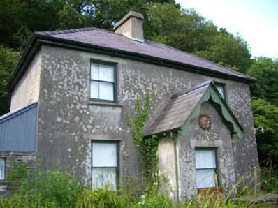
Detached three-bay two-storey house, built c.1900, with gabled porch and two-storey lean-to to rear (north) and single-storey lean-to to side (west). Hipped slate roofs with rendered chimneystacks and cast-iron and uPVC rainwater goods, bargeboards to porch and rear extension. Roughcast rendered walls with harp motif to porch. Square-headed openings with one-over-one timber sliding sash windows having concrete sills. Square-headed door opening with timber battened door and stone steps. Limestone boundary walls with wrought-iron gates. Two-storey over basement rubble stone former outbuilding to rear, now in domestic use.
A well portioned house which is retains an interesting harp motif. This motif, of a winged maiden harp surrounded by a garland of shamrocks, is an unusual addition. The harp symbol is a traditional symbol of Ireland and has been for hundreds of years. The winged maiden harp was a symbol of the United Irishmen in 1798 and used on their medals and flags. However, the winged maiden harp was also used as a British symbol of Ireland from c.1690 and throughout the eighteenth and nineteenth-century, but this version unusually had a crown. The Nationalist Celtic Revival, Home Rule movement, Land League and Ancient Order of the Hibernians all utilised the traditional symbols of Ireland, including the harp. This building may have functioned as some kind of a meeting house in the late nineteenth or early twentieth century.
From the Buildings of Ireland (National Inventory of Architectural Heritage) record 20914211
This does not grant access. Most recorded buildings are privately owned; view them only from public ground unless the owner allows entry.
Places near here
Photo credits
- National Inventory of Architectural Heritage
- Wsiegmund, Wikimedia Commons · CC BY 2.5
- Gordon Hatton, Geograph · CC BY-SA 2.0
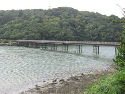 Poulgorm BridgeBridge · 215 ydWild Atlantic WayVisitor information · 337 ydBig HeightMountain / peak · 368 ydChildrens Burial Ground (Disused)Burial ground · 486 ydCnoc BuíMountain / peak · 547 ydMyross PointHeadland · 588 ydEnclosure in Aghatubrid MoreEnclosure · 731 ydTobar na gCapallSpring · 736 ydCarrigeenNamed rock · 759 yd
 walled garden844 yd
 Sitka Spruce1225 yd
 Prison CoveBeach / strand · 2.1 mi
More historic places in County Cork · All of County Cork
What do you know about this place?