What is recorded here
In rough grazing, on gentle W-facing slope, E of Glandore Harbour. Arc (C 24m) formed by earthen bank (H 0.8m) survives to N.
From the National Monuments Service (Archaeological Survey of Ireland) record CO142-024
The monument record does not grant public access. Check the route and ask the landowner before entering private land.
- What survives
- Recorded monument
Places near here
Photo credits
- National Inventory of Architectural Heritage
- Wsiegmund, Wikimedia Commons · CC BY 2.5
- A.-K. D., Wikimedia Commons · CC BY-SA 4.0
- Superbass, Wikimedia Commons · CC BY-SA 4.0
- Aaro Koskinen, Wikimedia Commons · Attribution
- Gordon Hatton, Geograph · CC BY-SA 2.0
Myross PointHeadland · 421 ydWild Atlantic WayVisitor information · 494 yd Poulgorm BridgeBridge · 573 ydArdagh CottageHouse · 731 ydBig HeightMountain / peak · 1053 ydSitka Spruce1218 ydCnoc BuíMountain / peak · 1276 ydTobar na gCapallSpring · 1441 ydFulacht fia in Drombeg (carbery E. (w.d.) By.)Fulacht fia · 2.0 miStone CircleStone circle, multiple-stone · 2.0 miDrombeg Stone CircleArchaeological place · 2.0 miPrison CoveBeach / strand · 2.1 mi
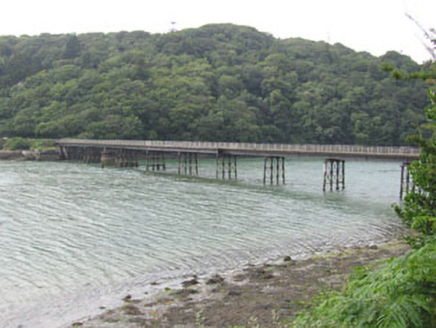 Poulgorm BridgeBridge · 573 yd
 Ardagh CottageHouse · 731 ydBig HeightMountain / peak · 1053 yd
 Sitka Spruce1218 ydCnoc BuíMountain / peak · 1276 ydTobar na gCapallSpring · 1441 yd
 Fulacht fia in Drombeg (carbery E. (w.d.) By.)Fulacht fia · 2.0 mi
 Stone CircleStone circle, multiple-stone · 2.0 mi
 Drombeg Stone CircleArchaeological place · 2.0 mi
 Prison CoveBeach / strand · 2.1 mi
More archaeology and monuments in County Cork · All of County Cork
What do you know about this place?