What is recorded here
From OpenStreetMap (© OpenStreetMap contributors) w1027106636
Places near here
Picture notes
- National Inventory of Architectural Heritage
- A McCarron, Wikimedia Commons · CC BY-SA 2.0
- Computer-made picture. It does not show this mountain top.
- Rossographer, Wikimedia Commons · CC BY-SA 2.0
- Robert Bone, Wikimedia Commons · CC BY-SA 2.0
- Computer-made picture. It does not show this monument.
- Joseph Mischyshyn, Geograph · CC BY-SA 2.0
- Computer-made picture. It does not show this walking route.
- Computer-made picture. It does not show this playground.
- Joseph Mischyshyn, Wikimedia Commons · CC BY-SA 2.0
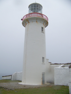 Aran Island LighthouseLighthouse · 2 yd
Explorer Tom Aran Island Lighthouse is standing on that dramatic coast, looking all elegant and granite. Get a photo with it before it gets a better agent and moves to the Hamptons or something.
 Tor an ÉidighHeadland · 1611 yd
Explorer Tom Tor an Éidigh is recorded as a headland in County Donegal. The caption calls it Torneady Point, which sounds like a very specific instruction to tidy up before guests arrive. I reckon the headland keeps its own schedule.
 Cnoc an FhrancaighMountain / peak · 1.4 miComputer-made picture
Explorer Tom Cnoc an Fhrancaigh sounds fancy, but it's likely just a hill with an accent. French people probably got lost here in 1740. Have a sandwich here and call it a heritage lunch to sound cultured.
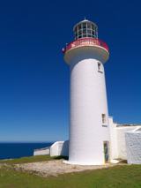 Arranmore / Árainn MhórIsland · 1.8 mi
Explorer Tom Arranmore / Árainn Mhór is a living island with beaches, Irish words in the air and a walk towards the lighthouse. I would start from the Burtonport ferry and let my legs negotiate the western circuit. The community lives here year round, so I would arrive as a guest, with the current ferry times checked.
 Cairn on Cnoc an IolairPublicly named cairn · 1.9 mi
Explorer Tom Cairn on Cnoc an Iolair sits on a place that sounds like it’s waiting for a giant eagle to land. Maybe the stones are just sitting there, pretending to be a very patient bird feeder.
 Cnoc an IolairMountain / peak · 2.0 miComputer-made picture
Explorer Tom Cnoc an Iolair means the Eagle's Hill, or something similar, so act like a bird of prey. Flap around a bit, look fierce, maybe screech at a sheep. Bring a pen pal, they'll be jealous of your epic bird-like adventures.
 Wayside shrine2.8 miComputer-made picture
Explorer Tom Wayside shrine is an accessible spot for a quick spiritual check-in. I bet it’s a favorite stop for locals and visitors alike, offering a moment of respite. It’s a simple yet meaningful feature in the Donegal environment.
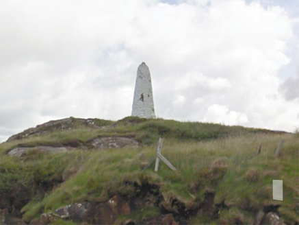 An Staca Mór [Stackamore]Beacon · 2.9 mi
Explorer Tom An Staca Mór [Stackamore] is a white stone navigation beacon near the channel to Arranmore. It may date from around 1810. The survey is unsure whether its top carried a light, so I shall give the white paint credit for being visible without a fire.
 EarlysPub · 3.0 mi
Explorer Tom Earlys in County Donegal had Daniel O'Donnell play there! Tell them Tom wanted to sing along, even if it was off-key.
 Slí Árann Mhór LoopOfficial walking route · 3.1 miComputer-made picture
Explorer Tom Slí Árann Mhór Loop is a seventeen-kilometre loop that will absolutely destroy your shins. Five hours? More like five days if you stop for snacks. Wave at the cows, they’re the only locals with actual jobs.
 Children's playground3.5 miComputer-made picture
Explorer Tom Children's playground in County Donegal needs a backstory, so I’m making one up right now about a buried pirate treasure. You can believe it if you want, I’ll swear on my life. Make up your own legend and I'll swear it's true.
 An tÍochtarIsland · 3.8 mi
Explorer Tom An tÍochtar is out here looking like it wants a nap, tucked away in County Donegal. Snap one photo, then put the phone away and actually look, because my eyes are starting to cross from squinting.
More historic places in County Donegal · All of County Donegal

What do you know about this place?Tap to add a comment or ask a question