
What is recorded here
From OpenStreetMap (© OpenStreetMap contributors) n332373229
Places near here
Photo credits
- National Inventory of Architectural Heritage
- Rod Grealish, Geograph · CC BY-SA 2.0
- Maker not stated on source page, uk.pinterest.com
- Maker not stated on source page, www.pinterest.com
- Humphrey Bolton, Geograph · CC BY-SA 2.0
- Dr Neil Clifton, Geograph · CC BY-SA 2.0
- Maker not stated on source page, ru.pinterest.com
- Patrice78500, Wikimedia Commons · Public domain
- Andreas F. Borchert, Wikimedia Commons · CC BY-SA 3.0 de
- Maker not stated on source page, www.tripadvisor.ca
- Kenneth Allen, Wikimedia Commons · CC BY-SA 2.0
 Owenwee BridgeBridge · 2.0 mi
Explorer Tom Owenwee Bridge crosses the river on one broad arch, with long rock-faced stones set around its curve. Built around…
 Droichead na hAbhna Bige [Owenbeg Bridge]Bridge · 2.0 mi
Explorer Tom Droichead na hAbhna Bige has these really long, squinty stones in the arch that look totally different from the chunky…
 Astelleen Burn WaterfallWaterfall · 2.1 mi
Explorer Tom Astelleen Burn Waterfall is the reward for carrying on beyond Glenveagh Castle when everyone else has decided the…
 Gallagher's IsleIslet · 2.2 mi
Explorer Tom Gallagher's Isle is telling the new development next door that it was here first and has better stories to tell. It’s…
 Standing stone in CrockrawStanding stone · 2.5 mi
Explorer Tom Standing stone in Crockraw is standing on boggy land like it’s the king of the hill, which is quite cheeky given the…
 Glenveagh Tea RoomCafé · 2.7 mi
Explorer Tom Glenveagh Tea Room has donuts and bagels that have seen things no pastry should ever see in its life. They close at…
 Wilkin's of Church HillPub · 3.3 mi
Explorer Tom Wilkin's of Church Hill in County Donegal sounds like it's guarded by an angel who demands tips for listening to your…
 Man-made underground passage in Church HillMan-made underground passage · 3.3 mi
Explorer Tom Man-made underground passage in Church Hill was a drystone box buried beneath the earth, recorded back in 1953. Sadly…
 Páirc Naisiúnta Ghleann Bheatha - Glenveagh National ParkNature reserve · 3.7 mi
Explorer Tom Glenveagh National Park is Donegal giving you room to breathe on a grand scale: lough, bog, woodland and mountain all…
 MoylenanavMountain / peak · 4.4 mi
Explorer Tom Right then, folks, here’s Moylenanav, standing tall in the misty corners of County Donegal. I’m still trying to work…
 Templedouglas CemeteryGraveyard · 4.9 mi
Explorer Tom Templedouglas Cemetery in County Donegal is playing hide-and-seek with me. A tale from 1846 says an earl built it, but…
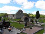 Stackarnagh Abbey GraveyardGraveyard · 4.9 mi
Explorer Tom Stackarnagh Abbey Graveyard has a gatepost detail I keep coming back to: a reused window fragment carved with a fish…
More mountains and hills in County Donegal · All of County Donegal

What do you know about this place?Tap to add a comment or ask a question