
What is recorded here
From the National Monuments Service (Archaeological Survey of Ireland) record DG052-008
Places near here
Photo credits
- National Inventory of Architectural Heritage
- Maker not stated on source page, uk.pinterest.com
- Maker not stated on source page, ru.pinterest.com
- Dr Neil Clifton, Geograph · CC BY-SA 2.0
- Malene Thyssen, Wikimedia Commons · CC BY-SA 3.0
- Ross, Wikimedia Commons · CC BY-SA 2.0
- Geraldine Diver / Donegal Daily, www.donegaldaily.com
- Kenneth Allen, Geograph · CC BY-SA 2.0
- Humphrey Bolton, Geograph · CC BY-SA 2.0
- Chris Gunns, Wikimedia Commons · CC BY-SA 2.0
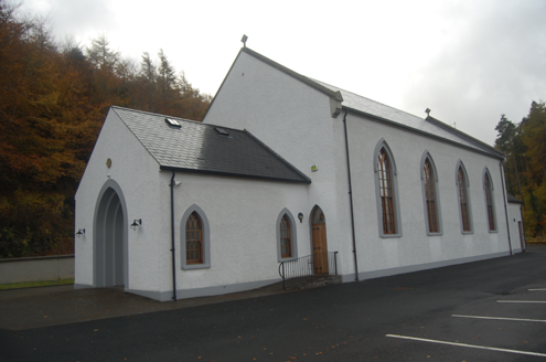 Saint Colmcille's Catholic ChurchChurch/chapel · 1028 yd
Explorer Tom Saint Colmcille's Catholic Church was built around 1830, with a porch added around 1850. The inventory records carved…
 Gallagher's IsleIslet · 1409 yd
Explorer Tom Gallagher's Isle is telling the new development next door that it was here first and has better stories to tell. It’s…
 Man-made underground passage in Church HillMan-made underground passage · 1.2 mi
Explorer Tom Man-made underground passage in Church Hill was a drystone box buried beneath the earth, recorded back in 1953. Sadly…
 Wilkin's of Church HillPub · 1.3 mi
Explorer Tom Wilkin's of Church Hill in County Donegal sounds like it's guarded by an angel who demands tips for listening to your…
 Church Hill Post OfficeHouse · 1.3 mi
Explorer Tom Church Hill Post Office was built around 1830 as part of a nine-bay block. Two bays belonged to the post office and…
 Man-made underground passage in Keeloges (church Hill Ed)Man-made underground passage · 1.5 mi
Explorer Tom Man-made underground passage in Keeloges rests on Kinahan's 1887 mention of an artificial cave on Leafin Hill. Later…
 European Beech1.9 mi
Explorer Tom European Beech in County Donegal would cope on a reality show by just standing there while everyone else argues about…
 Glebe House and GalleryHeritage attraction · 1.9 mi
Explorer Tom Glebe House and Gallery has an artist's eye at one end and Lough Gartan trying very hard to outshine it at the other. I…
 Páirc Naomh Columba, GlenswillyGAA ground · 4.0 mi
 Gregory HillMountain / peak · 4.1 mi
Explorer Tom Gregory Hill stands in County Donegal, keeping its access details firmly unknown. The name sounds like a word you’d…
 Glenveagh Tea RoomCafé · 4.5 mi
Explorer Tom Glenveagh Tea Room has donuts and bagels that have seen things no pastry should ever see in its life. They close at…
 Battle at Doon Rock, KilmacrennanBattle · 5.1 mi
Explorer Tom Battle at Doon Rock, Kilmacrennan in County Donegal is where Sir Cahir O'Doherty finally lost his battle against a…
More archaeology and monuments in County Donegal · All of County Donegal

What do you know about this place?Tap to add a comment or ask a question