Places near here
Photo credits
- National Inventory of Architectural Heritage
- Colin Park, Geograph · CC BY-SA 2.0
- Alison Cassidy, Wikimedia Commons · CC BY-SA 4.0
- Kmcnamee, Wikimedia Commons · CC BY-SA 4.0
Explorer Tom Another field boundary in An Inse Mhór, this one on the bog. Curvilinear stone traces sticking out like old bones. It’s…
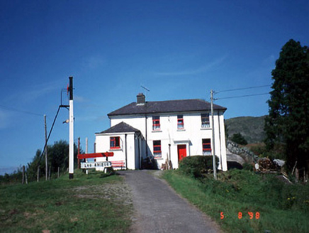 railway station2.9 mi
Explorer Tom Railway station in Derreenacullig is claimed by a local who says he invented the concept of waiting. Opened in 1893, it…
 bridge2.9 mi
Explorer Tom Bridge in Derreenacullig would date a tractor if it had a phone number and a dating profile. It spent decades carrying…
 The Paps WestMountain / peak · 4.0 mi
Explorer Tom The Paps West has been in a furious fairy dispute over parking rights with the clouds for the last three centuries. The…
Sli Gaeltacht MuscraiWalking route · 4.1 miExplorer Tom Sli Gaeltacht Muscrai was once tried to be bought by a very determined cow who kept grazing on the signposts. The…
Cascade WoodWood · 4.6 miExplorer Tom Cascade Wood inspired someone to write a poem that rhymed ‘tree’ with ‘sea’ and then just gave up after two lines…
Castle (Site of)Castle, unclassified · 4.7 miExplorer Tom The Castle in An Sliabh Riabhach is stuck up on a rocky hillock. The O Herlihy clan had a go at building here, but it’s…
 St Gobnets WellHoly well · 4.8 mi
Explorer Tom St Gobnets Well is the final stop on a pilgrimage and has heard every 'Ave' and 'Gloria' since the dawn of time, so…
 Naomh Abán GAA pitchGAA ground · 4.9 miCastleCastle, unclassified · 5.0 mi
Explorer Tom Castle in Cúil An Mhothair makes the wild claim that it is older than the hills surrounding it, scattered with loose…
 CrohaneMountain / peak · 5.3 mi
Explorer Tom Crohane in County Kerry would write on its dating profile that it’s looking for someone who doesn’t mind a bit of grit…
Glenflesk GAA pitchGAA ground · 5.5 miMore mountains and hills in County Kerry · All of County Kerry

What do you know about this place?Tap to add a comment or ask a question