Places near here
Photo credits
- Herbert Ortner, Wikimedia Commons · CC BY 3.0
- Ronan Mac Giollapharaic, Wikimedia Commons · CC BY-SA 4.0
- James Yardley, Wikimedia Commons · CC BY-SA 2.0
- National Inventory of Architectural Heritage
- Paucabot, Wikimedia Commons · CC BY-SA 3.0
- Tom Pullman, Wikimedia Commons · CC BY-SA 2.0
- Marathon, Geograph · CC BY-SA 2.0
- Gordon Hatton, Wikimedia Commons · CC BY-SA 2.0
- Gordon Hatton, Geograph · CC BY-SA 2.0
 ÁrainnIsland · 841 yd
 Dermot and Granias BedWedge tomb · 1580 yd
Explorer Tom Dermot and Granias Bed is a wedge tomb shaped like a giant slice of cheese. It’s got overlapping slabs on top, so it really knows how to layer things. Pack a picnic and an excuse.
 TempleancheathrairaluinnChurch · 1.1 mi
Explorer Tom Templeancheathrairaluinn would spend its lotto win on new flowers and a really nice altar cloth. It’s dedicated to four beautiful saints who definitely knew how to party. Ideal for a moody photo you'll pretend wasn't posed.
 Scoil Náisiúnta an Cheathrar ÁlainnSchool · 1.2 mi
Explorer Tom Scoil Náisiúnta an Cheathrar Álainn looks like a house but with oculus windows that make the map makers question their own sanity every time. Hum something sad nearby, and maybe the rubble walls will finally crack a smile.
 Dún EochlaHeritage attraction · 1.3 mi
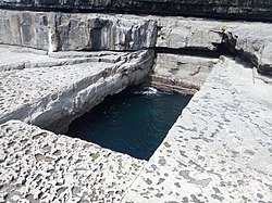 Poll na bPéistHeritage attraction · 1.4 mi
 DoocaherPromontory fort, coastal · 1.6 mi
Explorer Tom Doocaher in Cill Éinne is sick of being asked if it’s haunted because it’s just really windy up there on that cliff top. It’s not ghosts, mate, it’s just the Atlantic being dramatic about its existence. Ten minutes here and you'll have a yarn for the pub.
 Seal Colony LookoutViewpoint · 1.6 mi
 The Fir Bolg: Dún AonghasaLegend location · 2.0 mi
Explorer Tom The Fir Bolg: Dún Aonghasa has a mighty stone fort and a name tied to their leader Aonghas. If I had a fort named after me, I would be unbearable about it for years. The real walls are impressive enough; the name brings the Fir Bolg tale along for the ride.
 Arkin's CastleCastle · 2.6 mi
 Dún ConchúirFort · 5.7 mi
 Inis MeáinIsland · 5.9 mi
More mountains and hills in County Galway · All of County Galway

What do you know about this place?Tap to add a comment or ask a question