What is recorded here
Located in the N of a graveyard (DG084-001002-), which is enclosed within the S half of an ecclesiastical enclosure (DG084-001001-). Not shown on the 1836 OS 6-inch map, but indicated as ‘Altar’ on the 1907 edition, this altar (Wth 1.05m; D 0.0.45m; H 0.63m) is roughly constructed of drystone walling. It is built…
Read the whole record
From the National Monuments Service (Archaeological Survey of Ireland) record DG084-001008
Places near here
Photo credits
- louise price, Wikimedia Commons · CC BY-SA 2.0
- louise price, Geograph · CC BY-SA 2.0
- National Inventory of Architectural Heritage
- louise price, Geograph · Creative Commons Attribution-ShareAlike 2.0
- Kenneth Allen, Geograph · CC BY-SA 2.0
- Benson Wills, Wikimedia Commons · CC BY-SA 2.0
 Disert GraveyardGraveyard · 6 yd
Explorer Tom Disert Graveyard is a D-shaped pocket inside two larger enclosures, with at least 34 low uninscribed grave markers noted across its centre. The account also records a striking custom: people took soil from near the altar because it was reputed to drive rats from houses. I'd keep that as a belief people held, not a promise from the place.
 Dolmen at DisertPublicly named tomb or grave · 56 yd
Explorer Tom Dolmen at Disert is supposedly where a chieftain druid went to sleep. I bet he cast a really long nap spell and forgot the wake-up word! Now he’s just napping under the stones, probably snoring in ancient Gaelic.
 CarnaweenMountain / peak · 1.2 mi
Explorer Tom Carnaween has Diarmuid Ó Duibhne hiding in its name, at least in the old local telling. There was even a first-Sunday-in-June climb in the record. I would ask the hero whether he liked hills this much, but I would check current access before trying to follow him.
 Cloghmeen HillMountain / peak · 1.5 mi
Explorer Tom Cloghmeen Hill overlooks the 'deserted lands of Cronagass and Meentacreeghan'. I suspect those names are what happens when a mapmaker gets tired, spills ink, and just stops caring about pronunciation.
 Tullytrasna Standing StonePublicly named standing stone · 2.4 mi
Explorer Tom Tullytrasna Standing Stone is probably just one very tall rock that forgot to sit down. It looks like it’s straining its ears, trying to hear if anyone is calling for help from the other side of the hill.
 Church of the Holy RedeemerChurch/chapel · 2.8 mi
Explorer Tom Church of the Holy Redeemer has a bell donated in 1934 by the Revd. Daniel S. Sheerin for his parents. I bet he rang it really loud just to make sure they could hear him from wherever they were.
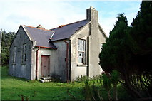 Lettermore National SchoolSchool · 2.8 mi
Explorer Tom Lettermore National School, dated 1909, stands as a detached two-bay former national school on a T-shaped plan, now derelict.
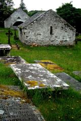 Inishkeel Graveyard near GlentiesGraveyard · 4.8 mi
Explorer Tom Inishkeel Graveyard near Glenties was rectangular in the older survey, but its south side sat on part of a roughly circular rise. Some of that rise lay beyond the west wall, about fifty metres across. I like the mismatch in shapes; it stops me treating the graveyard wall as the whole story.
 GlentiesHostel · 5.7 mi
Explorer Tom Glenties Hostel is where you go to sleep in a bed that has seen too much. Bring an earplug, because snoring is guaranteed here.
 St. Connell's Museum and Heritage CentreMuseum · 5.7 mi
Explorer Tom St. Connell's Museum and Heritage Centre lets me go from an old courtroom to the cells below, then into stories of the workhouse and Donegal railways. That is a lot of Glenties history packed into one building. I would leave the cells to the displays and keep my own visit on the friendly side of the door.
 Kennedy's Bar and RestaurantRestaurant · 5.7 mi
Explorer Tom Kennedy's Bar and Restaurant is definitely hiding a secret menu involving only cabbage and regret. I bet the barman knows more about ghosts than he does about cocktails, so keep your ears peeled for whispers while you eat.
 Donegal CastleCastle, tower house · 6.2 mi
Explorer Tom Donegal Castle is a massive tower house that survived being burned, demolished, and converted into a Jacobean manor. You can still see the carved Brooke fireplace with its intricate strapwork and armorial coats of arms inside. It’s a proper architectural time capsule where history got very messy.
More archaeology and monuments in County Donegal · All of County Donegal

What do you know about this place?Tap to add a comment or ask a question