What is recorded here
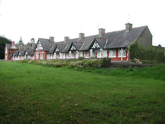
Terrace of eighteen two-bay single and two-storey almshouses, built 1889, with open gable-fronted porches. Central pair of houses in higher two-bay gabled projection. Two-storey T-shaped former director's house and hall attached to north. Complex now in use as sheltered housing units. Pitched slate roofs having rendered chimneystacks. Spirelet with roundels to director's house. Timber bargeboards and timbered gables to porches, with carved timber supports. Enclosed carved timber porch to director's house. Red brick walls with brick plinth. Timber casement windows with raised render block-and-start surrounds, single and quadripartite to director's house and tripartite to almoners' houses. Tudor-arch openings with timber battened doors. Single-storey outhouse returns to rear of almshouses. Gate piers with alternating bands of brick and stone and with wrought-iron gates and cast-iron railings to site boundary.
Designed by Albert E. Murray to provide homes for widows over sixty years and named after its patron Emma Stanwix (Stannix), this complex still provides sheltered housing today. Built in an asymmetrical picturesque brick and half-timbered manner, its long low form and broken massing give it a domestic scale, in contrast to the institutional nature of the former workhouse which fulfilled a similar function in housing the poor. Almshouse groups are a rare type in Ireland and the intact nature of the Thurles example makes it particularly important.
From the Buildings of Ireland (National Inventory of Architectural Heritage) record 22312105
This does not grant access. Most recorded buildings are privately owned; view them only from public ground unless the owner allows entry.
Places near here
Photo credits
- National Inventory of Architectural Heritage
- Lár na Páirce Museum, Wikimedia Commons · CC BY 2.0
- Mike Searle, Geograph · CC BY-SA 2.0
- Mike Searle, Wikimedia Commons · CC BY-SA 2.0
- Willow, Wikimedia Commons · CC BY 2.5
- Steven Brown, Geograph · Creative Commons Attribution-ShareAlike 2.0
- Paddy Ryan, Wikimedia Commons · CC BY-SA 4.0
 InnisfailHouse · 139 yd
 Mount Saint BenedictHouse · 349 yd
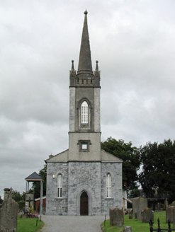 Saint Mary's Church (Thurles)Church/chapel · 385 ydSt. Mary's Famine and War MuseumMuseum · 392 ydEnclosure in Glebe (thurles Par.)Enclosure · 415 yd
 Lár na PáirceMuseum · 1000 yd
 Black CastleCastle · 1158 yd
 Black CastleCastle, tower house · 1161 yd
 European ash1579 ydEuropean ash2.5 mi
 Grave YardGraveyard · 9.3 mi
 Devil's Bit MountainMountain / peak · 11 mi
More historic places in County Tipperary · All of County Tipperary
What do you know about this place?