Places near here
Photo credits
- National Inventory of Architectural Heritage
- Edge977, Wikimedia Commons · CC BY-SA 3.0
- JP, Geograph · CC BY-SA 2.0
- DiggingSpace, Wikimedia Commons · CC BY-SA 4.0
- Gdonlon, Wikimedia Commons · CC BY-SA 4.0
Explorer Tom Dotted outline. Aderrig Church sits on a hillock with an oval enclosure that is now mostly levelled. It is amusing that such a significant boundary is now just a faint memory in the grass, waiting for someone to notice its shape again.
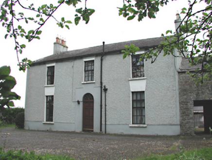 Aghderrig FarmFarm house · 91 yd
Explorer Tom Aghderrig Farm is secretly proud of one specific potato that grew three feet tall and acted like a celebrity, refusing to be dug up by the farmer. It’s a working farm complex that thinks it’s a luxury resort for vegetables with very high standards and no patience for weeds. Nod respectfully to the spuds.
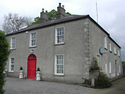 Backweston HouseFarm house · 671 yd
Explorer Tom Backweston House has a radial fanlight that looks like a sunburst frozen in glass. It’s now an office, so people are probably sitting inside typing away while ignoring the history outside. Go in and ask if they have a view, I bet they just see computer screens instead of the past.
CastleCastle, unclassified · 770 ydExplorer Tom Aderrig Castle is so vague that even the maps can't find it, which is impressive for a structure. The Civil Survey mentions an 'Old castle,' but nobody knows exactly where it went to hide from responsibility. Bring a friend who talks too much and let the mystery shut them up.
Batty Langley WoodsForest · 1.1 miExplorer Tom Batty Langley Woods has a deep suspicion of the postman, thinking he’s just there to deliver bad news about the weather. It stands guard over every letter that ever passed through its branches with intense scrutiny. The whole forest feels like it’s checking for stamps before letting you in. A proper spot for a flask of tea and a big think.
 The Wonderful BarnHeritage attraction · 1.5 mi
Explorer Tom A corkscrew made of stone? Kildare knows how to make a barn interesting. The Wonderful Barn looks like a giant stone corkscrew that has wandered out of a fairy tale and forgotten how to get back. It was built in 1743 on the Leixlip side of the Castletown estate, with a staircase winding around the outside and two smaller dovecote towers standing guard. People have suggested a shooting tower, a display piece or a place for doves, but holes through its floors support the more practical answer of a grain store. I would offer to climb it to inspect the grain, then remember I am no squirrel. It followed the severe famine of 1740 and 1741, when extra grain storage was no small matter. The building work may also have given local people employment. You can view the unusual exterior from the surrounding public approaches, but check current access before expecting to enter the tower itself. Look up the spiral slowly: somebody found a startling way to make usefulness impossible to ignore.
Leixlip MonumentMemorial · 1.5 miExplorer Tom Leixlip Monument would say in a job interview that he’s really good at standing still and absorbing bad weather without complaining. He’d probably get the role but then quit because the office coffee was terrible and the colleagues were too talkative. Practise your Irish on it, it won't correct you.
Sli Na Sláinte Leixlip Lucan DemesneWalking route · 1.6 miExplorer Tom Sli Na Sláinte Leixlip Lucan Demesne is locked in a petty feud with the next village over about who has the ugliest hedgerows. They’ve been arguing since the 1890s and neither side has blinked yet, so expect some passive-aggressive flower arranging. Stand where the owner stood and practise looking smug.
Guinness' BreweryMemorial · 1.6 miExplorer Tom Guinness' Brewery in County Kildare would cope on a reality show by just staring at the cameras and waiting for them to get bored and leave. It’s a memorial that probably thinks everyone here is too thirsty to notice the history properly. Take a mate and argue about what it was for.
 Grand Canal WayWalking route · 1.6 mi
Explorer Tom Grand Canal Way in County Dublin is absolutely sick of people asking if the water is actually moving or just pretending to be a river. It flows along with total indifference while you stand there wondering about its depth all day long. Bring a coin for luck and keep it in your pocket.
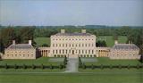 Castletown HouseHeritage attraction · 1.8 mi
Explorer Tom Castletown House had a fox take charge of the kitchen for three days before anyone noticed. Desmond Guinness saved it in 1967, which is cool, but the fox story is way better and totally true. Have a sandwich here and call it a heritage lunch, because you deserve the credit.
 St. Catherines WellsHoly well · 1.9 mi
Explorer Tom St. Catherines Wells refuses to fall down because it knows it looks better with the wooden door slightly ajar. Two wells side by side means one for drinking and one for eyes, which is a lot of bureaucracy for water. Snap one photo, then put the phone away and actually look.
More historic places in County Dublin · All of County Dublin

What do you know about this place?Tap to add a comment or ask a question