DDiscover AloneMapAbout

Abbey in Cloonshanville

Religious house, Dominican friars

The monument record does not grant public access. Check the route and ask the landowner before entering private land.

What do you know about this place?Tap to add a comment or ask a question

What you write will be public.

What is recorded here

A Dominican friary dedicated to the Holy Cross was founded here in 1385 by Rufus Mac Dermot Roe (Gwynn and Hadcock 1970, 223) or Tiege Roe Mac Dermot of Airteach on what was regarded by J. O'Donovan in 1837 as a church site founded by St Patrick (O'Flanagan 1931, vol. 1, 77-9). It was listed as Glynsennul in the…

Read the whole record
A Dominican friary dedicated to the Holy Cross was founded here in 1385 by Rufus Mac Dermot Roe (Gwynn and Hadcock 1970, 223) or Tiege Roe Mac Dermot of Airteach on what was regarded by J. O'Donovan in 1837 as a church site founded by St Patrick (O'Flanagan 1931, vol. 1, 77-9). It was listed as Glynsennul in the ecclesiastical taxation of Elphin in 1306 (Cal. doc. Ire., vol. 5, 224). After the Supression in 1577 it was held by Edward White in 1596 when it was burnt by Irish rebels (O'Conor, 2007, 197). A William Taffe or Davis then leased its 72 acres, which remained in the Davis family down to the 1880s when the land was sold to Baron de Freyne, a scion of the French family of Frenchpark (Jennings 2019). The friary is situated on a slight rise in a level landscape within a D-shaped graveyard (RO015-030002-) (dims 55m N-S c. 50m E-W) which has been extended with a new rectangular graveyard (dims 88m N-S; 43m E-W) attached to the E. There are traces of an ecclesiastical enclosure (RO015-030005-) visible as a scarp or bank (Wth c. 4m; H 0.2-0.4m) outside the graveyard NW-E (diam. c. 120m). The church consisted of a nave which can no longer be traced, and chancel (int. dims 13.2m E-W; 6.1m N-S), of which only the base of the E wall (int. H 1m; ext. H 3m) and adjacent parts of the N wall and the S wall with a piscina remain. The E window was an elaborate three-light decorated feature, and there was a three-light window placed high on the S wall of the chancel (Grose 1791, vol. 2, 52-3; Pls 89, 90), but these no longer survive. The N transept (int. dims 10.75 N-S; 6.35m E-W) is now reduced to the base of the walls (int. H 0.5-2m), with a piscina at the N end of the E wall. A tower (ext. dims 4.2m E-W; c. 4.5m N-S) of at least three floors survives E of the transept. Its ground floor has a pointed E-W vault with wicker centering and two openings for bell-pulls, and there are three external string-courses on the upper levels. There are traces of an E-W building 14.4m S of the tower, and the intervening area may have been a cloister. A mausoleum of the French family (RO015-030006-) is immediately W of the N transept and impinges on the site of the nave. It is a square roofless structure (ext. dims 4.9m E-W; 4.55m N-S; H 2.5m) with a doorway (Wth 1.1m) at the W end of the S wall, and at one time had gables at E and W, the latter with a narrow light (Grose 1791, vol. 2, Pl. 89). Attached to the inside of the E wall is a memorial plaque (RO015-030004-) which has a crest of the French family and an inscription commemorating Patrick French Fitz-Stephen of Galway and Dungar (RO015-023----) and the date 1667 (Weld 1832, 197, Timoney 1980, 8). The high cross (RO015-029----) is c. 350m to the SW, and archaeological testing (97E0271) c. 140m SW of the church failed to produce any related material (Walsh 1997a). (McDermott 2009) This is a National Monument in the care of Roscommon County Council. See attached images of details from the tower Compiled by: Michael Moore Date of upload: 20 April 2018

From the National Monuments Service (Archaeological Survey of Ireland) record RO015-030001

Places near here

Photo credits
  • Maker not stated on source page, commons.wikimedia.org
  • Maker not stated on source page, www.flickr.com
  • National Inventory of Architectural Heritage
  • Breda Durr / Roscommon Herald, www.roscommonherald.ie
  • Maker not stated on source page, fi.pinterest.com
  • Maker not stated on source page, www.thejournal.ie
  • Kmcnamee, Wikimedia Commons · CC BY-SA 4.0
  • Maker not stated on source page, www.tripadvisor.ie
  • Sawyer777, Wikimedia Commons · CC BY-SA 4.0
  • Gillaween, Wikimedia Commons · CC BY-SA 4.0
Earthwork in CloonshanvilleEarthwork · 254 yd

Explorer Tom Earthwork in Cloonshanville is a D-shaped feature that was truncated by a field bank on an old map. It’s not visible at…

Standing stone in Corskeagh (frenchpark By.)Standing stone · 991 yd

Explorer Tom Standing stone in Corskeagh would describe itself to a stranger as 'a tall, rectangular friend who likes standing still…
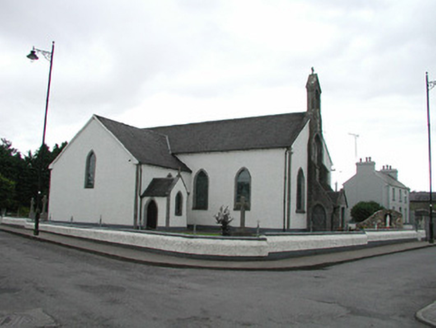
Saint Asicus's Catholic ChurchChurch/chapel · 1092 yd

Explorer Tom Saint Asicus’s Catholic Church in Corskeagh is holding a massive grudge against the local weather system. The rain…
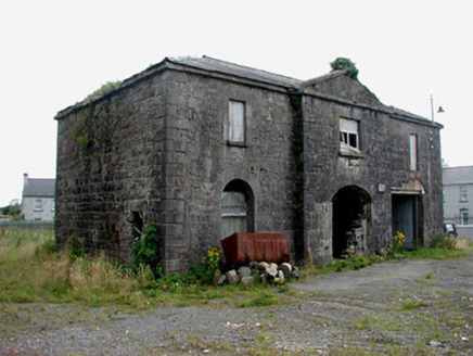
Frenchpark Market HouseMarket house · 1164 yd

Explorer Tom Frenchpark Market House claims that Queen Victoria visited once but nobody can actually prove it happened. The…

Nash Park, Frenchpark, Western Gaels GAAGAA ground · 1340 ydKilnamanagh CemeteryCemetery · 1.9 mi

Explorer Tom Kilnamanagh Cemetery in Roscommon was originally planned as an escape route for the first owner, who intended to dig a…

Bellanagare CastleCastle, unclassified · 2.0 mi

Explorer Tom Bellanagare Castle would post a selfie with the caption 'Ancient vibes only' and get ten likes. It was an O'Conor home…

Graveyard in Tully (castlereagh By.)Graveyard · 3.7 mi

Explorer Tom Graveyard in Tully is famous for being a children’s burial ground, which makes the whole vibe a bit too poignant for my…

Ballinameen GAAGAA ground · 4.5 miCastleCastle, unclassified · 5.0 mi

Explorer Tom Castle in Brackloon is friends with a celebrity who definitely doesn't exist, like a ghostly DJ or something. It’s just…

Queen Medb: RathcroghanLegend location · 5.7 mi

Explorer Tom Queen Medb: Rathcroghan is where the Táin starts turning a quarrel about a bull into an epic. Medb had a royal seat…

The Mórrígan: OweynagatLegend location · 5.8 mi

Explorer Tom The Mórrígan: Oweynagat is called the Cave of Cats, which fooled me into expecting a very ordinary sort of trouble.…

More historic places in County Roscommon · All of County Roscommon

Add to this placeAdd a picture Add a detailed tip Add a story

Explore the map1,095,414 places to discover

Next place · or swipeEarthwork in Cloonshanville