Places near here
Photo credits
- National Inventory of Architectural Heritage
- Joseph Mischyshyn, Geograph · CC BY-SA 2.0
- Bob Jones, Wikimedia Commons · CC BY-SA 2.0
- N Chadwick, Geograph · CC BY-SA 2.0
- nick macneill, Geograph · CC BY-SA 2.0
- N Chadwick, Wikimedia Commons · CC BY-SA 2.0
- Colin Park, Geograph · CC BY-SA 2.0
- N Chadwick, Geograph · Creative Commons Attribution-ShareAlike 2.0
- NateBergin, Wikimedia Commons · CC BY 4.0
- WikiDon at English Wikipedia, Wikimedia Commons · CC BY-SA 3.0
- Eddylandzaat, Wikimedia Commons · CC BY 3.0
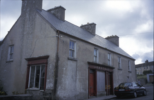 ArmsteadHouse · 1096 yd
Explorer Tom Armstead in Ardnacullia North has timber shopfronts inserted around 1900, which makes it look like it’s trying to sell something but forgot what. It’s disused now, so it’s just brooding with its lined-and-ruled walls. Bring wellies and low expectations, leave delighted.
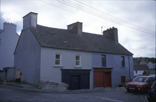 Blake and LinnaneHouse · 1124 yd
Explorer Tom Blake and Linnane in Ennistimon had a poet fall in the ditch nearby in 1830, or so the rumours go. The shopfronts are gone now, but the building still looks like it’s judging your outfit choices from behind its sashes. Bring wellies and low expectations, leave delighted.
 Famine MemorialMemorial · 1.2 mi
Explorer Tom Famine Memorial stands as a solemn reminder of the past, honoring the victims of Ireland's great tragedy in County Clare.
 Dough CastleRuins · 2.8 mi
Explorer Tom Dough Castle is a former tower house situated on a rocky knoll above the River Inagh, close to O'Brien's Bridge.
 Castle (in ruins)Castle, tower house · 2.8 mi
Explorer Tom Castle in Dough is sitting on sand dunes next to a golf course. I bet the caddies used it as a locker room back in the day. Mind the nettles, because they are definitely the real guards here and they bite.
 Lahinch BeachBeach / strand · 2.9 mi
Explorer Tom Lahinch Beach lies near Lehinch, offering a classic Irish coastal scene that has captured many photographers’ hearts.
 High CrossVisitor attraction · 5.1 mi
Explorer Tom High Cross has me thinking it’s the same as the other High Cross, but I’m still confused.
 Burren Centre KilfenoraVisitor information · 5.1 mi
Explorer Tom Burren Centre Kilfenora is a haven for those seeking the beauty of the Burren in County Clare
 Graveyard5.1 mi
Explorer Tom Graveyard in Kilfenora wraps around the cathedral with a rubble wall. There's a fairy dispute over parking rights at the gate that has gone on for years. Give it a pat on the way past, it's had a long life.
 Cathedral (in ruins)Cathedral · 5.1 mi
Explorer Tom Cathedral in Kilfenora has been a diocese since 1152 and still won't fall down. Make a wish, it's had centuries of practice at ignoring modern property disputes.
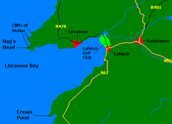 Liscannor BayBay · 5.1 mi
Explorer Tom Liscannor Bay curves gently around here, a place where the water meets the land in a quiet, welcoming embrace for visitors.
 SlievecallanMountain / peak · 6.2 mi
Explorer Tom Slievecallan, a mountain that’s as rugged as the winter landscape it’s dressed in during January.
More historic places in County Clare · All of County Clare

What do you know about this place?Tap to add a comment or ask a question