
What is recorded here
On a N-facing slope in Kilfenora Village. A graveyard around Kilfenora C of I church (CL016-015004-) and cathedral (CL016-015002-), slightly trapezoidal in plan (67m E-W; 30m N-S at E; 26.5m N-S at W), with a roughly coursed rubble wall (H 1.5-1.95m; Wth 0.5-0.64m) all around. Some very large stones are evident at the base of the wall externally at E. There are two entrance gateways, one in the middle of the W wall and one at the SE corner. The W gateway is more elaborate and has a pointed arch door (Wth 1.43m; H 2.13m) opening through a rectangular structure (overall Wth 2.83m). The doorway is of well-cut stones with both internal and external chamfers. The smaller door in the S end of the E wall is flat-headed and lintelled (H 1.67m; Wth 0.85m). It has straight ingoings and a drawbar socket at the N side. It occupies a small projection in the SE corner. The graveyard is described by Rogers (2002, 9) as ‘small, tightly packed with burials and has been in use for at least 900 years and possibly more’. High crosses that once stood in the graveyard were moved c. 2005 into the Lady Chapel of the cathedral to ensure their preservation. The following images have been uploaded:
CL016-015003-_01.jpg E wall of graveyard from SE. CL016-015003-_02.jpg View across graveyard from ESE. CL016-015003-_03.jpg W gateway exterior. CL016-015003-_04.jpg SE doorway exterior.
On a N-facing slope in Kilfenora Village. A graveyard around Kilfenora C of I church (CL016-015004-) and cathedral (CL016-015002-), slightly trapezoidal in plan (67m E-W; 30m N-S at E; 26.5m N-S at W), with a roughly coursed rubble wall (H 1.5-1.95m; Wth 0.5-0.64m) all around. Some very large stones are evident at the base of the wall externally at E. There are two entrance gateways, one in the middle of the W…
From the National Monuments Service (Archaeological Survey of Ireland) record CL016-015003
The monument record does not grant public access. Check the route and ask the landowner before entering private land.
- What survives
- Recorded monument
Places near here
 Saint Fachtnan's CathedralCathedral · 23 yd
 Cathedral (in ruins)Cathedral · 41 yd
 CrossCross, High cross · 41 yd
 High CrossHeritage attraction · 46 yd
 Burren Centre KilfenoraVisitor information · 82 yd
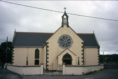 Saint Fachanan's Catholic ChurchChurch/chapel · 150 yd
 Smithstown Castle (in ruins)Castle, tower house · 2.2 mi
 Ballyganner Castle (in ruins)Castle, tower house · 2.3 miBallyteigue Nature ReserveNature reserve · 3.1 mi
.jpg/250px-Cahermacnaghten_(geograph_4680299).jpg "Photo: Gordon Hatton, Wikimedia Commons · CC BY-SA 2.0") Cahermacnaghten CashelHeritage attraction · 3.9 miCullaun 5 (C5b)Cave · 4.3 mi
Cahermacnaghten CashelHeritage attraction · 3.9 miCullaun 5 (C5b)Cave · 4.3 mi Famine MemorialMemorial · 5.4 mi
Pictures: Andreas F. Borchert, Wikimedia Commons · CC BY-SA 4.0; NateBergin, Wikimedia Commons · CC BY 4.0; N Chadwick, Geograph · CC BY-SA 2.0; Colin Park, Geograph · CC BY-SA 2.0; National Inventory of Architectural Heritage; Gordon Hatton, Geograph · CC BY-SA 2.0; Roger Diel, Geograph · CC BY-SA 2.0; Gordon Hatton, Wikimedia Commons · CC BY-SA 2.0; Joseph Mischyshyn, Geograph · CC BY-SA 2.0
More archaeology and monuments in County Clare · All of County Clare
What do you know about this place?