What is recorded here
When he died in 1623 Richard Whitty possessed 180 acres at Ballyteige together with the castle (WX052-018001-) and windmill (Jeffrey 1979, 61-3). According to the Civil Survey (1654-6) a mill at Ballyteige was owned by Richard Whitty in 1640 (Simington 1953, 133, 163), and according to the Down Survey parish map (1656-8) of Kilmore Ballyteige then included what later became the townlands of Beak, Libgate and Chapel. For the Down Survey parish map see this web-page accessed on 17 February, 2014: http://downsurvey.tcd.ie/down-survey-maps.php#bm=Bargy&c=Wexford&p=Killmore+and+Killkowan
Two windmills, placed c. 150m apart, are marked on the 1839 ed. of the OS 6-inch map at Chapel. The western mill (WX052-019----) was built in 1836, so this eastern windmill is more likely to have been an early mill. It is situated on a level landscape, but had been removed by 1925 (OS 6-inch map). It is not visible at ground level in a lawn.
When he died in 1623 Richard Whitty possessed 180 acres at Ballyteige together with the castle (WX052-018001-) and windmill (Jeffrey 1979, 61-3). According to the Civil Survey (1654-6) a mill at Ballyteige was owned by Richard Whitty in 1640 (Simington 1953, 133, 163), and according to the Down Survey parish map (1656-8) of Kilmore Ballyteige then included what later became the townlands of Beak, Libgate and…
From the National Monuments Service (Archaeological Survey of Ireland) record WX052-052
The monument record does not grant public access. Check the route and ask the landowner before entering private land.
- What survives
- Recorded monument
Places near here
Photo credits
- National Inventory of Architectural Heritage
- Kenneth Allen, Geograph · CC BY-SA 2.0
- Mike Searle, Wikimedia Commons · CC BY-SA 2.0
- kevin higgins, Geograph · CC BY-SA 2.0
- kevin higgins, Wikimedia Commons · CC BY-SA 2.0
- ArcticEmmet, Wikimedia Commons · Public domain
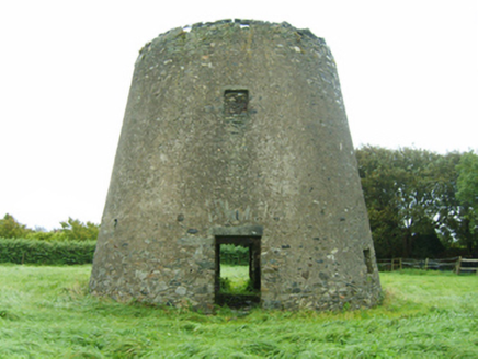 mill (wind)161 yd
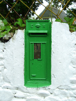 post box161 ydEmbanked enclosureFairy fort / earthen ringfort · 283 ydEnclosure in Grange (bargy By., Kilmore Ed)Enclosure · 757 ydIvan Sutton Art ExhibitionGallery · 1.1 mi
 Kilmore Quay - Crehen Twinning MemorialMemorial · 1.2 mi
 Kilmore Quay Walking TrailVisitor information · 1.4 mi
_-_geograph.org.uk_-_3715787.jpg/250px-Castles_of_Leinster,_Ballyhealy,_Wexford_(1)_-_geograph.org.uk_-_3715787.jpg "Photo: Mike Searle, Wikimedia Commons · CC BY-SA 2.0") Castle (in ruins)Castle, tower house · 1.7 mi
Castle (in ruins)Castle, tower house · 1.7 mi Cull IslandIsland · 3.3 mi
 Ballyteigue BurrowNature reserve · 3.4 mi
 Little SalteeIslet · 3.4 mi
 Great SalteeIsland · 5.2 mi
More archaeology and monuments in County Wexford · All of County Wexford
What do you know about this place?