What is recorded here
Located on a level landscape, and just S of an E-W road that curves around the perimeter NNW-NNE. This is a slightly raised and grass-covered subcircular area (dims 45m N-S; 37m E-W) defined by a degraded earthen bank (Wth c. 3m; int. H 0.4-0.9m; ext. H 0.9-1.2m) with an external stone facing. There is no visible fosse or entrance but there is a hedge on the perimeter S-NW.
From the National Monuments Service (Archaeological Survey of Ireland) record WX052-020
The monument record does not grant public access. Check the route and ask the landowner before entering private land.
- What survives
- Recorded monument
Places near here
Photo credits
- National Inventory of Architectural Heritage
- Kenneth Allen, Geograph · CC BY-SA 2.0
- Mike Searle, Wikimedia Commons · CC BY-SA 2.0
- kevin higgins, Geograph · CC BY-SA 2.0
- kevin higgins, Wikimedia Commons · CC BY-SA 2.0
- ArcticEmmet, Wikimedia Commons · Public domain
Windmill283 yd post box440 ydmill (wind)444 ydEnclosure in Grange (bargy By., Kilmore Ed)Enclosure · 536 ydIvan Sutton Art ExhibitionGallery · 1.3 miKilmore Quay - Crehen Twinning MemorialMemorial · 1.3 miKilmore Quay Walking TrailVisitor information · 1.5 miCastle (in ruins)Castle, tower house · 1.5 miCull IslandIsland · 3.4 miBallyteigue BurrowNature reserve · 3.6 miLittle SalteeIslet · 3.6 miGreat SalteeIsland · 5.3 mi
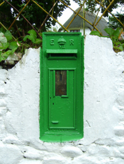 post box440 yd
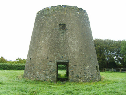 mill (wind)444 ydEnclosure in Grange (bargy By., Kilmore Ed)Enclosure · 536 ydIvan Sutton Art ExhibitionGallery · 1.3 mi
 Kilmore Quay - Crehen Twinning MemorialMemorial · 1.3 mi
 Kilmore Quay Walking TrailVisitor information · 1.5 mi
_-_geograph.org.uk_-_3715787.jpg/250px-Castles_of_Leinster,_Ballyhealy,_Wexford_(1)_-_geograph.org.uk_-_3715787.jpg "Photo: Mike Searle, Wikimedia Commons · CC BY-SA 2.0") Castle (in ruins)Castle, tower house · 1.5 mi
Castle (in ruins)Castle, tower house · 1.5 mi Cull IslandIsland · 3.4 mi
 Ballyteigue BurrowNature reserve · 3.6 mi
 Little SalteeIslet · 3.6 mi
 Great SalteeIsland · 5.3 mi
More archaeology and monuments in County Wexford · All of County Wexford
What do you know about this place?