Places near here
Photo credits
- National Inventory of Architectural Heritage
- Charles T. G. Clarke, Wikimedia Commons · CC BY-SA 4.0
- Malene Thyssen, Wikimedia Commons · CC BY-SA 3.0
- Algirdas at Lithuanian Wikipedia, Wikimedia Commons · Public domain
- Richard Webb, Geograph · CC BY-SA 2.0
- Gillaween, Wikimedia Commons · CC BY-SA 4.0
- 2ManyCats4Me, Wikimedia Commons · CC0
Explorer Tom Fairy fort or earthen ringfort in Shrubbywood in County Westmeath is claimed by a local who says he invented it because…
 worker's house1.8 mi
Explorer Tom Worker's house in Correaly, County Westmeath is a pair of modest homes that locals swear will haunt you if you don’t…
 Float Railway StationRailway station · 1.8 mi
Explorer Tom Float Railway Station in Lisduff is sick of being asked if the train ever came back, so just nod and move on before it…
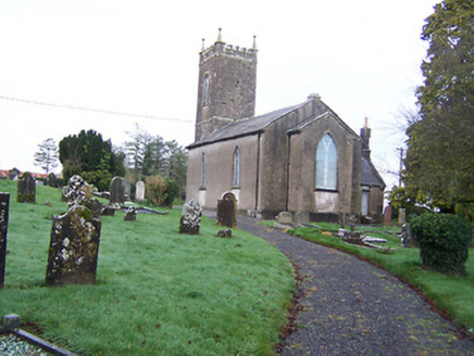 Saint Nicholas's Church (Mayne)Church/chapel · 2.0 mi
Explorer Tom Saint Nicholas's Church in Mayne refuses to fall down because it’s too proud of its early nineteenth-century bones.…
 Coolamber CastleHouse, fortified house · 2.8 mi
Explorer Tom Coolamber Castle House is where Saint Patrick would have said, ‘You’ve got a bit of an ego for a pile of rocks.’…
 European Beech3.7 mi
Explorer Tom European Beech in County Westmeath claims to hear everything through its walls, including your embarrassing phone calls…
 Pedunculate Oak3.9 mi
Explorer Tom Pedunculate Oak in County Westmeath witnessed a love story that went badly wrong when one party dropped their ring into…
 CastleCastle, motte · 4.0 mi
Explorer Tom Castle in Russagh handles its nosey neighbours by simply not being there anymore, which is the ultimate…
 Sheela-na-gig in AbbeylaraSheela-na-gig · 5.3 mi
Explorer Tom Sheela-na-gig in Abbeylara has been staring into the void for centuries, and I swear she’s judging your outfit while…
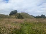 Granard MotteMotte-and-bailey castle remains · 6.8 mi
Explorer Tom Granard Motte would describe the 1800s to a teenager as 'basically a long queue for nothing'. It's just a big mound…
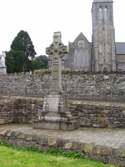 1798 MonumentMonument · 6.8 mi
Explorer Tom The 1798 Monument in Granard uses a Celtic high cross style to tell you about a battle that happened two hundred years…
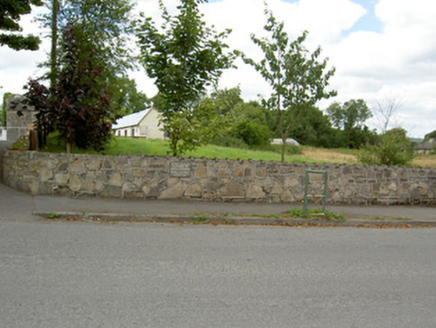 Bully's AcreGraveyard/cemetery, unknown · 12 mi
Explorer Tom Bully's Acre in Ballinalee is a graveyard where rabbits think they own the place, but really it holds the rebels from…
More archaeology and monuments in County Westmeath · All of County Westmeath

What do you know about this place?Tap to add a comment or ask a question