What is recorded here
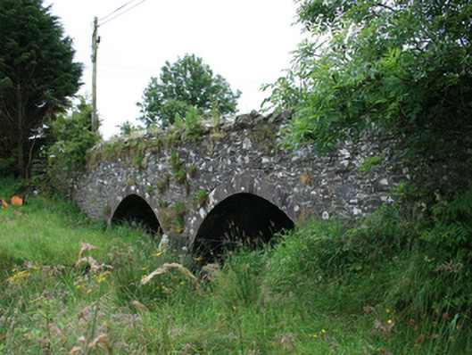
Double-arch rubble stone road bridge, built c.1820, spanning Barora River. Slightly humped tarmacadam deck with random-coursed rubble stone parapets having Scotch coping. Random rubble stone spandrels and wing walls. Segmental arches with regular ashlar voussoirs and rendered random rubble barrel. Central pier with dressed stone V-cutwaters.
A substantial rural bridge with differing stone treatments clearly articulating the various functions of each element. The fine cut stone of the arch contrasts with the rustic appearance of the roadside parapet copings. The bridge formed part of the historic road infrastructure of the county, connecting the towns of Mullagh and Bailieborough, thereby playing a part in the social and economic development of the county. The bridge demonstrates the skill of the stone masons involved in its construction and its twin arches make a strong contribution to the historic built environment in the rural landscape.
From the Buildings of Ireland (National Inventory of Architectural Heritage) record 40403409
This does not grant access. Most recorded buildings are privately owned; view them only from public ground unless the owner allows entry.
Places near here
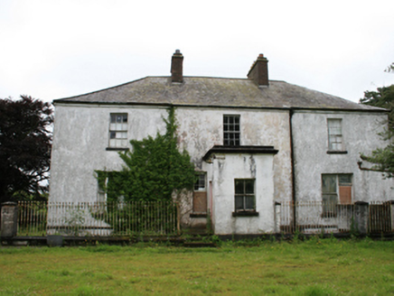 rectory/glebe/vicarage/curate's house1400 ydBlackhills LowerMountain / peak · 1618 ydMoatCastle, motte and bailey · 1.3 mi
 Church (in ruins)Church · 1.4 mi
 Grave YardGraveyard · 1.4 mi
 LoughanleaghForest · 2.7 mi
 Brothers GravesVisitor information · 2.8 mi
 Welcome to Bailieborough DemesneVisitor information · 3.6 mi
 EnaghMountain / peak · 4.2 mi
 Windmill in Enagh (crossbane Ed)Windmill · 4.2 mi
 Fair of MuffMemorial · 4.3 mi
 Sessile Oak6.0 mi
Pictures: National Inventory of Architectural Heritage; Kevgorman, Wikimedia Commons · CC BY-SA 4.0; Oliver Dixon, Geograph · CC BY-SA 2.0; Kieran Campbell, Geograph · CC BY-SA 2.0; Maker named on the Wikimedia Commons picture page · CC BY-SA 2.5
More historic places in County Cavan · All of County Cavan
What do you know about this place?