
What is recorded here
Rathdonnell Fort is a subcircular area (DG052-007001-) enclosed by a massive earthen bank up to 1.3m in height on the interior and from 3.5m to 4m on the exterior. To the SE there are vague traces of a shallow ditch and 7.5m to the SW a smaller earthen bank, continuing as a field boundary, follows the curve of the…
Read the whole record
From the National Monuments Service (Archaeological Survey of Ireland) record DG052-007002
Places near here
Photo credits
- National Inventory of Architectural Heritage
- Maker not stated on source page, au.pinterest.com
- Maker not stated on source page, commons.wikimedia.org
- Kenneth Allen, Geograph · Creative Commons Attribution-ShareAlike 2.0
- Maker not stated on source page, en.wikipedia.org
- Maker not stated on source page, www.tripadvisor.ca
- Kenneth Allen, Wikimedia Commons · CC BY-SA 2.0
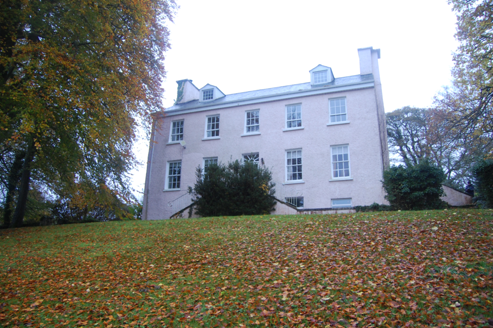 Rathdonnell HouseCountry house · 65 yd
Explorer Tom Rathdonnell House sits beside a ringfort, which I bet is just a giant stone hat left behind by a very confused giant.…
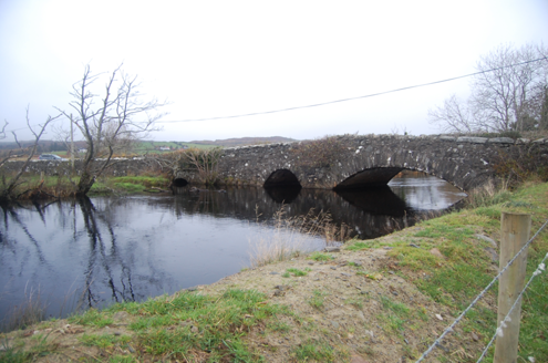 Bellaned BridgeBridge · 794 yd
Explorer Tom Bellaned Bridge uses one wide arch and a smaller pointed one over the Lennan River, with two little flood arches beside…
 Standing stone in GarrowcarryStanding stone · 1485 yd
Explorer Tom Standing stone in Garrowcarry is officially gone, but Tom swears it just moved house to avoid paying council tax. He…
 Standing stone in SockarStanding stone · 1.0 mi
Explorer Tom Standing stone in Sockar is a pair of stones that Kinahan noted back in the late 1800s. They’ve both vanished from the…
 Trenta Presbyterian ChurchChurch/chapel · 1.0 mi
Explorer Tom Trenta Presbyterian Church was built around 1836, with a porch dated 1902. Its coloured glass sits in pointed windows…
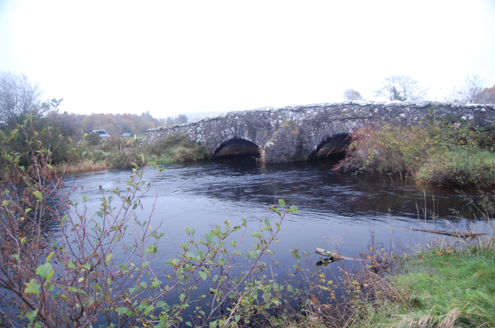 Dromore BridgeBridge · 1.2 mi
Explorer Tom Dromore Bridge has carried a road over the Leanne River since around 1780. Its two stone arches may contain pieces of…
 bridge1.4 mi
Explorer Tom Bridge in Carnatreantagh has blue engineering brick voussoirs tucked inside a stone arch. Why would an engineer pick…
 Carrick Children's Burial GroundChildren's burial ground · 1.4 mi
Explorer Tom Carrick Children's Burial Ground is a subrectangular patch of stony ground hidden in the rough, rocky terrain here.…
 Barrack BridgeBridge · 1.5 mi
Explorer Tom Barrack Bridge was built around 1800 with two round arches over the Leannan River and an oversized triangular cutwater…
 Burial within Labra Lark's CastleBurial · 1.7 mi
Explorer Tom Burial within Labra Lark's Castle sits inside a massive double-walled fortress on a rocky ridge in Cloncarney. Fagan’s…
 Templedouglas CemeteryGraveyard · 2.3 mi
Explorer Tom Templedouglas Cemetery in County Donegal is playing hide-and-seek with me. A tale from 1846 says an earl built it, but…
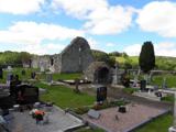 Stackarnagh Abbey GraveyardGraveyard · 2.3 mi
Explorer Tom Stackarnagh Abbey Graveyard has a gatepost detail I keep coming back to: a reused window fragment carved with a fish…
More archaeology and monuments in County Donegal · All of County Donegal

What do you know about this place?Tap to add a comment or ask a question