
What is recorded here
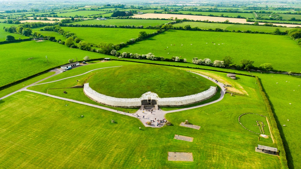
Situated on a slight SE-facing slope in a gently undulating landscape. Archaeological testing (03E1331) by S. Halliday identified archaeological features in Area 13B of the N2 Finglas to Ashbourne road and bypass (excavations.ie 2003:1424) which were subsequently excavated by C. Moore under the same licence…
Read the whole record
From the National Monuments Service (Archaeological Survey of Ireland) record ME045-028
Places near here
Photo credits
- Maker not stated on source page, ru.pinterest.com
- Maker not stated on source page, www.flickr.com
- Maker not stated on source page, en.wikipedia.org
- Maker not stated on source page, ru.wikipedia.org
- Maker not stated on source page, ms.fusedlearning.com
- National Inventory of Architectural Heritage
- Maker not stated on source page, www.pinterest.com
- Maker not stated on source page, www.gaia.com
- Jonjobaker, Wikimedia Commons · CC BY-SA 4.0
 Fairy fort / earthen ringfort in WottonFairy fort / earthen ringfort · 1443 yd
Explorer Tom Fairy fort in Wotton has walls thin enough to hear the neighbours arguing about the bin. It’s a small circle that…
 Fairy fort / earthen ringfort in Donaghmore (ratoath By.)Fairy fort / earthen ringfort · 1580 yd
Explorer Tom Fairy fort / earthen ringfort in Donaghmore: The weather has a long-standing grudge against this ring, probably because…
 Enclosure in Rath (ratoath By., Greenoge Par.)Enclosure · 1.3 mi
Explorer Tom Enclosure in Rath would say in a job interview that it has strong roots and excellent visibility from the air, which is…
 CastleCastle, unclassified · 2.0 mi
Explorer Tom Castle in Coolatrath East, County Dublin was recorded in a 1650s survey but not precisely located, which is annoying.…
 Enclosure in Irishtown (dunboyne By.)Enclosure · 2.0 mi
Explorer Tom Enclosure in Irishtown has a tiny ring-ditch inside, like a secret room for its own thoughts. It's probably saying rude…
 Fairy fort / earthen ringfort in KilleglandFairy fort / earthen ringfort · 2.2 mi
Explorer Tom Fairy fort / earthen ringfort in Killegland had an escape plan involving a stream and a lot of mud. Its first owner…
 Jordanstown HouseFarm house · 3.2 mi
Explorer Tom Jordanstown House is an 1850 farmhouse with original crown glass windows that are definitely seeing things from way…
 Church (site of)Ecclesiastical enclosure · 3.6 mi
Explorer Tom Church in Kilmartin is just a ghostly outline now, levelled out by the earthworks department back in the seventies.…
 Fairy fort / earthen ringfort in BallintryFairy fort / earthen ringfort · 3.7 mi
Explorer Tom Fairy fort / earthen ringfort in Ballintry is where the Vikings got lost looking for it. They swore they saw it, but…
 presbytery/parochial/curate's house3.7 mi
Explorer Tom The presbytery in Oldtown would post a selfie of its uPVC porch with the caption 'living my best 1870 life' and get…
 Catholic Church of Our Lady Queen of PeaceChurch/chapel · 3.7 mi
Explorer Tom Catholic Church of Our Lady Queen of Peace is a gable-fronted church built in 1962 where the shortcut to the back…
 Graveyard in Cloghran (castleknock By.)Graveyard · 4.7 mi
Explorer Tom Graveyard in Cloghran started as a bet between two lads in the pub who dared each other to build it on a quarried edge…
More archaeology and monuments in County Meath · All of County Meath

What do you know about this place?Tap to add a comment or ask a question