What is recorded here
Wedge tomb in Glanatnaw is a roofless stone chamber hidden beneath heather and gorse on a ridge above the Cork valleys. It is locally called the Soldier's grave, a name that suggests somebody important once lay inside the narrow wedge of slabs. The chamber still points east-west across the pasture, waiting for rain, foottraffic and memory to finish what time began.
In rough hill pasture, on a ridge extending SW from Bull Rock peak with fine views over the surrounding valleys and hills. The tomb is enveloped in peat and largely concealed by heather and gorse. The remains consist of a roofless wedge-shaped gallery (L 2.55m; Wth 1.55 at W, narrowing to 1.1m at E), aligned ENE-WSW, closed at the E end by an inset backstone (H 0.57m). The N side is formed by a single slab and the S by three inward leaning slabs (overall L 2.75m); the two W stones overlap. Two small stones set immediately S of the chamber indicate possible outer-walling. This wedge tomb is locally known as the 'Soldier's grave'.
The above description is derived from 'The Archaeological Inventory of County Cork. Volume 5' (Dublin: Stationery Office, 2009).
Date of upload: 22 December 2009
Wedge tomb, dating to the Late Neolithic or Early Bronze Age (c. 2500–1000 BCE). Its location on a prominent ridge suggests it may have had ritual or territorial significance in the landscape.
The monument record does not grant public access. Check the route and ask the landowner before entering private land.
- What survives
- Recorded monument
Places near here
 Enclosure in Dromore (carbery W. (w.d.) By.)Enclosure · 1300 yd
 Wedge tomb in Kealanine (carbery W. (w.d) By.)Wedge tomb · 1497 yd
 Dromore Schoolschool · 1.1 mi
 Francis O'Neill PlaqueMemorial · 1.3 mi
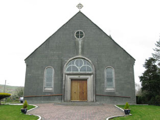 St. Joseph's Roman Catholic Churchchurch/chapel · 1.3 mi
 Trawlebane WalkWalking route · 2.3 mi
 Baugorm Castle (Site of)Castle, unclassified · 2.4 mi
 Mullach MéiseMountain / peak · 2.7 mi
 Castle DonovanCastle · 2.9 mi
 Delish Cascade WalkWalking route · 3.1 mi
 Seskin ViewViewpoint · 4.3 mi
 Graveyard in TownlotsGraveyard · 4.5 mi