
Places near here
Photo credits
- National Inventory of Architectural Heritage
- Geraldine Diver / Donegal Daily, www.donegaldaily.com
- Kenneth Allen, Wikimedia Commons · CC BY-SA 2.0
- Kenneth Allen, Geograph · CC BY-SA 2.0
- Andreas F. Borchert, Wikimedia Commons · CC BY-SA 4.0
- Balloholic (talk), Wikimedia Commons
- Ian S, Geograph · CC BY-SA 2.0
- MaxPride, Wikimedia Commons
 Rashedoge BridgeBridge · 459 yd
Explorer Tom Rashedoge Bridge humps its one stone arch over the River Swilly, carrying a laneway on top. Built around 1800, it has…
 Páirc Naomh Columba, GlenswillyGAA ground · 903 yd
 Fox HallWalled garden · 907 yd
Explorer Tom Fox Hall's walled garden was laid out around 1860 with rubble stone walls and a red-brick arch over its south entrance.…
 Battle of ScarrifholisBattle · 1.5 mi
Explorer Tom Battle of Scarrifholis in County Donegal would walk into any job interview and say it has excellent conflict resolution…
 Gregory HillMountain / peak · 1.9 mi
Explorer Tom Gregory Hill stands in County Donegal, keeping its access details firmly unknown. The name sounds like a word you’d…
 Battlefield in Ardahee,ballyconnelly (ballymacool Ed),bomany,doon GlebeBattlefield · 1.9 mi
Explorer Tom Battlefield in Ardahee in Donegal gets picked on by the wind because it refuses to admit who actually won that fight…
 Conwal Wheeled Cross SlabCross-slab · 2.3 mi
Explorer Tom Conwal Wheeled Cross Slab is a tiny, battered fragment that survived the mess of a 1968 tidy-up. It’s just the top half…
 Godfrey O'Donnell GraveslabGraveslab · 2.3 mi
Explorer Tom Godfrey O'Donnell Graveslab claims to be the final resting spot of a guy who died in 1258. It’s got a wheeled-cross…
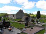 Stackarnagh Abbey GraveyardGraveyard · 2.5 mi
Explorer Tom Stackarnagh Abbey Graveyard has a gatepost detail I keep coming back to: a reused window fragment carved with a fish…
 Ballymacool ParkPark · 3.0 mi
Explorer Tom Ballymacool Park sits just outside Letterkenny with the excellent confidence of a place that knows a good hill, a broad…
 Tir na NogPub · 3.4 mi
Explorer Tom Tir na Nog sounds like a name invented by someone who had one too many pints. Bet they’ve got a special named after a…
 O’Donnell ParkGAA ground · 3.5 mi
Explorer Tom O’Donnell Park belongs to St Eunan’s in Letterkenny, and in 2026 Donegal chose it for a senior county championship…
More mountains and hills in County Donegal · All of County Donegal

What do you know about this place?Tap to add a comment or ask a question