
Places near here
Photo credits
- National Inventory of Architectural Heritage
- Kmcnamee, Wikimedia Commons · CC BY-SA 4.0
- Wanfried-Dublin, Wikimedia Commons · CC BY 4.0
- Fintan McTiernan / Monaghan GAA official Flickr, www.flickr.com
- Enda O Flaherty, Wikimedia Commons · CC BY-SA 2.0
- This file is from the Mechanical Curator collection , a set of over 1 million images scanned from out-of-copyright books and released to Flickr Commons by the British Library. View image on Flickr View all images from book View catalogue entry for book ., Wikimedia Commons · Public domain
- D Gore, Geograph · CC BY-SA 2.0
- Oliver Dixon, Geograph · CC BY-SA 2.0
 bridge21 yd
Explorer Tom House in Glaslough has an integral carriage arch that looks like it was designed by someone who really liked their…
 house, shop/retail outlet112 yd
Explorer Tom House, shop or retail outlet in Cornamucklaglass handles nosy neighbours with a stern brick glare. It’s part of a…
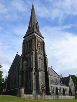 Saint Patrick's Catholic ChurchChurch/chapel · 115 yd
Explorer Tom Saint Patrick's Catholic Church has a local legend that a giant used to sneeze on it from the hilltop, flattening the…
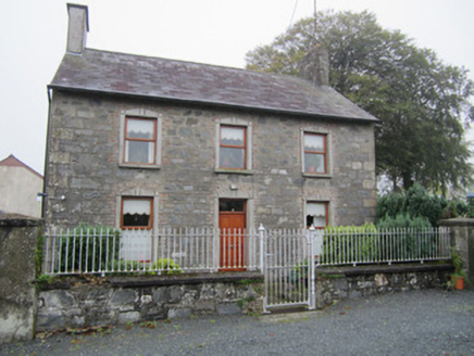 Hall Street National SchoolSchool master's house · 169 yd
Explorer Tom Hall Street Schoolmaster’s house is hiding a tunnel to the pub right beneath the slate roof, allegedly. The master…
The Rabbit BurrowWood · 474 ydExplorer Tom The Rabbit Burrow was the subject of such a fierce parish argument that they built a fence around it for peace. Nobody…
 Pearse Park, Ballybay Pearse BrothersGAA ground · 1.1 mi
 Portal tomb in LennanPortal tomb · 2.4 mi
Explorer Tom Portal tomb in Lennan is perched on a drumlin ridge, looking slightly tipsy from the wind. If it could order at a…
 Páirc Uí Néill, Doohamlet O'NeillsGAA ground · 3.4 mi
 Giants GreveWedge tomb · 6.3 mi
Explorer Tom "Giants Greve is hiding a scandal about a stone that wasn’t invited to the party. It’s been whispering secrets to the…
 Dartrey ForestForest · 6.7 mi
Explorer Tom Dartrey Forest used to have a great house at its centre, and the trees have done a fine job of carrying on without it.…
 Flagpole HillMountain / peak · 7.3 mi
Explorer Tom Flagpole Hill is the sort of peak that clearly had a mother-in-law design it, giving it that distinct look of…
 Bush IslandIslet · 9.0 mi
Explorer Tom Bush Island would survive a zombie attack by just being too small for them to bother with. It’s basically an…
More historic places in County Monaghan · All of County Monaghan

What do you know about this place?Tap to add a comment or ask a question