Places near here
Photo credits
- National Inventory of Architectural Heritage
- Kieran Campbell, Wikimedia Commons · CC BY-SA 2.0
- Christophe Krief, Wikimedia Commons · CC BY-SA 4.0
- Mike Searle, Geograph · CC BY-SA 2.0
- Peter Gerken, Wikimedia Commons · CC BY-SA 2.0
- Willow, Wikimedia Commons · CC BY 2.5
- Christopher Hilton, Wikimedia Commons · CC BY-SA 2.0
- Kieran Campbell, Geograph · CC BY-SA 2.0
- Arno-nl, Wikimedia Commons · CC BY-SA 4.0
- AndreasDelp, Wikimedia Commons · CC BY-SA 4.0
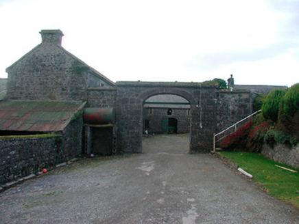 Dorrington HouseFarmyard complex · 504 yd
Explorer Tom Dorrington House in Walderstown has a hidden message carved into its stones that only the wind can read. It’s been whispering secrets to the carriage arch for decades, trying to tell the demolished main house where it went wrong. Listen closely next time the gusts blow; you might hear a grumble about poor planning.
 Killininneen HouseHouse · 1293 yd
Explorer Tom Killininneen House has had so many names it could fill a phone book, but it still looks like it just woke up from a long nap. The slate roof and sash windows are doing their best to look presentable despite the semi-derelict state of things around them. Bes
 CastleCastle, motte and bailey · 2.2 mi
Explorer Tom Dunnamona's motte is in a bitter feud with the next village over about who invented the perfect way to eat potatoes without butter. The tension is palpable; locals won't even look at each other across the field, making for an incredibly awkward picnic spot. Take the long way round, it deserves the effort.
 Athlone CastleVisitor information · 7.1 mi
Explorer Tom Athlone Castle is just standing there pretending it doesn’t remember the time a goat ruled the roost and ate all the royal documents. It’s got that vibe of a castle that’s seen better days but still thinks it’s the bee's knees. Tell your mates you found it first.
 Historic Town - Athlone Castle & Church of St Peter and PaulVisitor information · 7.2 mi
Explorer Tom Whoever built Athlone Castle was clearly thinking about how to make the church look good in bad weather, which is oddly specific genius. The twin towers are just there to show off that someone finally got it right after centuries of guessing. Make up your own legend and I'll swear it's true.
 Siege of AthloneSiege · 7.2 mi
Explorer Tom Another Siege of Athlone event is telling the place that replaced it to stop acting so modern, as if concrete is superior to old stone walls. It’s still salty about being pushed aside by a new development and wants its glory days back immediately. Dare you to say hello to it out loud.
 European ash8.1 mi
Explorer Tom European ash in County Westmeath is standing tall after a local priest lost a bet about how many leaves it has and now refuses to speak to him. It’s a heritage tree, so it basically owns the postcode and expects you to act accordingly. Tell your mates you found it first.
 RindoonWood · 9.6 mi
Explorer Tom Rindoon in County Roscommon has a hidden message carved into its stones that says 'I told you so' but nobody has managed to find it yet, which is frustrating. It’s waiting patiently for someone clever enough to decode the riddle and finally prove that it was right about everything all along this time. Tell it a joke, it's been a long time since anyone did.
 Rindown CastleCastle, Anglo-Norman masonry castle · 9.8 mi
Explorer Tom Rindown Castle would write 'looking for adventure' on its dating profile. It's got a bay nearby, so the views are decent if you ignore the overgrowth. It's free, it's odd, what more do you want?
 Safe HarbourBay · 9.8 mi
Explorer Tom Safe Harbour would post on social media with a filter that makes it look calm, but we all know it’s actually having a meltdown behind the rocks. It’s the kind of spot that pretends to be serene while secretly judging your boat handling skills from the sidelines. A handy spot to stretch your legs and your imagination.
 Historic town in Warren,rinnaganHistoric town · 10.0 mi
Explorer Tom Historic town in Warren has had more name changes than I've had bad haircuts this year. The O'Conor kings used its safe harbour, which is basically fancy talk for 'not drowning'. Find a local and ask them the real story, then come back and tell me.
 InchcleraunIsland · 12 mi
Explorer Tom Inchcleraun has two names, a monastery and enough legend to keep me talking well beyond the boat ride. It lies in Lough Ree between Roscommon and Longford, covering about fifty-eight hectares. Saint Diarmaid's community was founded around 560, leaving ruins now protected as a national monument. The Irish name points to Clothru, a queen in story, and Maeve also gets a chapter in the island's folklore. I would settle their argument over who owned the best view, but it is wiser to separate tales from surviving stone. There is no road across the lake; arrange a permitted boat, confirm landing and return, and respect the old religious ground. Look back at both shores once you arrive. The island sits between counties and between several very different kinds of history.
More historic places in County Westmeath · All of County Westmeath

What do you know about this place?Tap to add a comment or ask a question