
Places near here
Photo credits
- National Inventory of Architectural Heritage
- Rob Hurson, Wikimedia Commons · CC BY-SA 4.0
- Aubrey Martin, Wikimedia Commons · CC BY-SA 4.0
- Albert Bridge, Geograph · CC BY-SA 2.0
- Mike Searle, Geograph · CC BY-SA 2.0
- Sitomon, Wikimedia Commons · CC BY-SA 2.0
- Malene Thyssen, Wikimedia Commons · CC BY-SA 3.0
- Patrick Brown, Wikimedia Commons · CC BY-SA 2.0
- Anthony Foster, Geograph · CC BY-SA 2.0
- Anthony Foster, Wikimedia Commons · CC BY-SA 2.0
- August Schwerdfeger, Wikimedia Commons · CC BY 4.0
 post box100 yd
Explorer Tom Post box in Dillonsland is fixed to a telephone pole, which means its secret talent is being a very confused phone booth for letters. It has a P & T monogram and zero chill about where it stands. Bring a notebook and write the bit I made up.
 Boyne CottageWell · 103 yd
Explorer Tom Boyne Cottage is actually a well here, with a vaulted room cut into the river bank that looks like a cave for water gnomes. Someone once wrote a bad poem about its dampness, and I believe every word. Bring a jacket, it's never as warm as I promise.
 CastleCastle, motte · 232 yd
Explorer Tom This motte in Athlumney is jealous of the actual castle next door because nobody takes photos of it on purpose. It’s just a big dirt cone that dreams of having a roof one day. Stand on the spot and imagine the gossip it's heard from the river.
 Donaghmore Round TowerHeritage attraction · 1.6 mi
 Round Tower1.6 mi
Explorer Tom Round Tower in Donaghmore has a long-standing grudge against the wind, which keeps trying to blow it over. It’s survived centuries, so let the clouds have their moment. Tell it a joke, it's been a long time since anyone did.
 Dunmoe CastleCastle, unclassified · 2.4 mi
Explorer Tom Dunmoe Castle in Dunmoe was designed by a mother-in-law who wanted to see everyone sweat. Captain Power surrendered because he couldn't take her passive-aggressive notes anymore. Bring a map, get lost anyway, that's the fun.
 European Yew2.9 mi
Explorer Tom European Yew in County Meath once saw a farmer drop his lunch and swear for twenty minutes straight. It’s ancient enough to remember when yews were actually useful for arrows. Get a photo with it before it gets a better agent.
 European Beech3.7 mi
Explorer Tom European Beech in County Meath would order a massive chipper with extra vinegar and pretend it didn’t enjoy the crunch. It’s got a very posh attitude for something growing in mud. Snap one photo, then put the phone away and actually look.
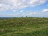 Hill of TaraVisitor information · 5.5 mi
 Saint Patrick'sMemorial · 5.5 mi
 Dumha na nGiallArchaeological place · 5.6 mi
 Lia Fáil: Hill of TaraLegend location · 5.6 mi
Explorer Tom Lia Fáil: Hill of Tara is a stone with high standards. Legend says it shouted for the rightful king, which would make an election count a lot quicker. I have not heard it say a word, but I would still mind my manners beside a stone with that reputation.
More historic places in County Meath · All of County Meath

What do you know about this place?Tap to add a comment or ask a question