
What is recorded here
Detached three-bay two-storey rendered house, built c. 1840, now in use as guest house. Two-storey canted bay projection to centre of south (front) elevation, single-storey canted entrance porch wrapped around canted bay, two-storey central return to rear, two-storey extension to return c. 1940, two-storey flat-roofed extension c. 1990 to north-west, single-storey conservatory c. 1950 to west elevation. Half-hipped slate roof, clay ridge and hip tiles, unpainted roughcast chimneystacks with stepped capping, half-round cast-iron gutters at eaves. Painted roughcast walling, painted chamfered plinth. Square-headed window openings, smooth-rendered reveals, painted stone sills, painted six-over-six timber sash windows. Round-headed entrance door opening to porch, hardwood sunburst fanlight, varnished hardwood timber-framed door c. 1960 with six glazed panels. Set back from road in landscaped grounds surrounded by mature farmland. Farmyard to rear (north); five-bay two-storey range of outbuildings with pitched slate roof, painted smooth-rendered walling, square-headed window and door openings; L-plan single-storey rubble stone outbuilding to north-east, hipped corrugated-iron roof. Rubble stone boundary walls, dressed stone gate piers, wrought-iron gates and field railings.
This substantially-intact group, consisting of farmhouse and farmyard, remains coherent in spite of incremental additions such as the wrap-around entrance porch and flat-roofed extension. Balanced proportions, slate roofing, rendered walling and sash windows found here are some of the basic components that characterise middle-size properties in the Sligo landscape. Of particular interest is a skillfully-crafted wrought-iron gate beside the main entrance (an almost identical gate is found at a school to the north of Lissadell).
From the Buildings of Ireland (National Inventory of Architectural Heritage) record 32400827
This does not grant access. Most recorded buildings are privately owned; view them only from public ground unless the owner allows entry.
Places near here
Tober PatrickArchaeological place · 255 yd Drumcliffe Co-Operative CreameryCreamery · 719 ydFloods WoodForest · 1142 ydCastle (in Ruins)Castle, unclassified · 1144 ydwater pump1729 ydCastleCastle, unclassified · 1.2 miCat CornerWood · 1.3 miStone crossCross, High cross · 1.4 miGrave of wb YeatsHeritage attraction · 1.4 miDrumcliff CemeteryGraveyard · 1.5 miBenbulbinMountain / peak · 1.9 miBenbulbenMountain · 2.2 mi
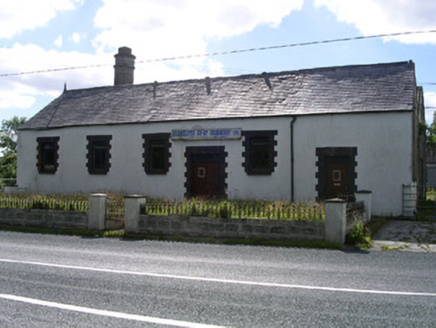 Drumcliffe Co-Operative CreameryCreamery · 719 ydFloods WoodForest · 1142 ydCastle (in Ruins)Castle, unclassified · 1144 yd
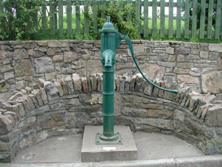 water pump1729 ydCastleCastle, unclassified · 1.2 miCat CornerWood · 1.3 mi
 Stone crossCross, High cross · 1.4 miGrave of wb YeatsHeritage attraction · 1.4 mi
 Drumcliff CemeteryGraveyard · 1.5 mi
.jpg/250px-Front_view_of_Benbulbin_(2013).jpg "Photo: IrishFireside, Wikimedia Commons · CC BY-SA 2.0") BenbulbinMountain / peak · 1.9 mi
BenbulbinMountain / peak · 1.9 mi BenbulbenMountain · 2.2 mi
Pictures: National Inventory of Architectural Heritage; Maelor at English Wikipedia, Wikimedia Commons · Public domain; Kenneth Allen, Geograph · Creative Commons Attribution-ShareAlike 2.0; IrishFireside, Wikimedia Commons · CC BY-SA 2.0; Hellowiki789, Wikimedia Commons · CC BY-SA 3.0
More historic places in County Sligo · All of County Sligo
What do you know about this place?