
What is recorded here
Places near here
Photo credits
- National Inventory of Architectural Heritage
- Maker not stated on source page, www.heartlandtravel.co.uk
- David Dixon, Geograph · CC BY-SA 2.0
- Maker not stated on source page, www.pinterest.com
- Maker not stated on source page, www.insidehook.com
- Richard Webb, Wikimedia Commons · CC BY-SA 2.0
- Maker not stated on source page, www.dreamstime.com
- Maker not stated on source page, www.tuatha.ie
- Andreas F. Borchert, Wikimedia Commons · CC BY-SA 4.0
- Golfing in Ireland; photographer not stated, Source publisher
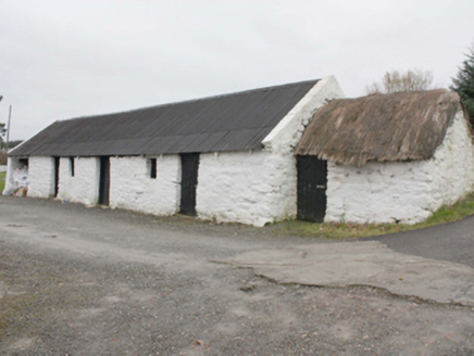 outbuilding1270 yd
Explorer Tom Outbuilding in Owenboy is a modest c. 1820 shed that’s somehow managed to keep its rope-and-peg thatch alive. It’s not…
 Standing stone in ShandrimStanding stone · 1307 yd
Explorer Tom Standing stone in Shandrim is actually lying down now, having fallen over on a rocky ridge. It has a shallow recess on…
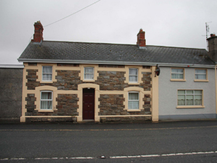 North PoleRailway station · 1691 yd
Explorer Tom North Pole station opened in 1901 as part of the narrow-gauge railway to Carndonagh, and now serves pints instead of…
 The North PolePub · 1696 yd
Explorer Tom The North Pole in Drumfree is geographically chaotic, claiming polar status while sitting in the middle of Donegal’s…
 Cist in SladranCist · 1.3 mi
Explorer Tom Cist in Sladran is a tiny stone-lined box, measuring just 1m by 0.72m and 0.63m deep, tucked away in a farmyard where…
 IllankillyIsland · 2.5 mi
Explorer Tom Illankilly in County Donegal is secretly proud of the one potato it grew last year, which I think was a very ambitious…
 Slieve MainMountain / peak · 2.7 mi
Explorer Tom Slieve Main is recorded as a mountain / peak in County Donegal, and it looks like a solid, reliable sort of hill. I…
 Greenhill GraveyardGraveyard · 2.8 mi
Explorer Tom Greenhill Graveyard has a curved wall that might follow an older enclosure, though the survey keeps that as a…
 Slieve SnaghtMountain / peak · 3.4 mi
Explorer Tom Slieve Snaght has a namesake in Donegal, so I checked the map twice before announcing that I had found the snow…
 CastleCastle, unclassified · 5.0 mi
Explorer Tom A castle stood beside the church at Straid in 1600, perhaps a stone house occupied by a priest named Amerson. Its exact…
 Clonmany Early Church GraveyardGraveyard · 5.0 mi
Explorer Tom Clonmany Early Church Graveyard hides a stone with two cupmarks called St. Colmcille's knee-prints. I reckon a kneeling…
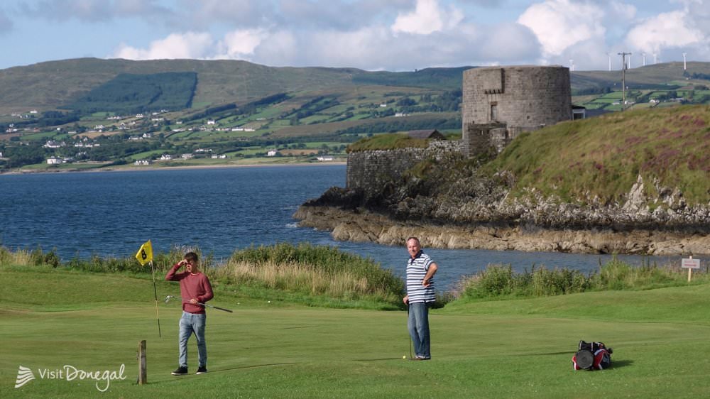 Otway Golf ClubGolf course · 5.9 mi
More walking routes in County Donegal · All of County Donegal

What do you know about this place?Tap to add a comment or ask a question