What is recorded here
From the National Monuments Service (Archaeological Survey of Ireland) record LH011-033
Places near here
Photo credits
- National Inventory of Architectural Heritage
- Maker not stated on source page, commons.wikimedia.org
- Maker not stated on source page, www.pinterest.com
- Richard Webb, Geograph · Creative Commons Attribution-ShareAlike 2.0
- Maker not stated on source page, www.gettyimages.in
- LouthHeritage, Wikimedia Commons · CC BY-SA 4.0
- Maker not stated on source page, ru.pinterest.com
- Maker not stated on source page, uk.wikipedia.org
- Maker not stated on source page, au.pinterest.com
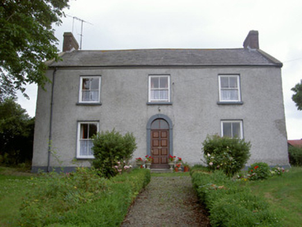 Pakenham HallHouse · 800 yd
Explorer Tom Pakenham Hall in Muff would bring a full three-course meal to any party it attends. It’s been standing there since 1806…
 Earthwork in KilleenEarthwork · 1102 yd
Explorer Tom Earthwork in Killeen is a mound that got flattened by early twentieth-century fashion trends, specifically the desire…
 farm house1363 yd
Explorer Tom Farm house in Tully is all thatch and charm, probably telling its job interview that it’s ‘rustic but reliable’ without…
 CastleCastle, unclassified · 1633 yd
Explorer Tom Toomes Castle is in a quiet drama with the nearest tree, arguing over who looks better in autumn. It’s a hill that used…
 Fairy fort / earthen ringfort in Lowrath NorthFairy fort / earthen ringfort · 1753 yd
Explorer Tom Fairy fort / earthen ringfort in Lowrath North is hiding from me. Some bloke wrote a poem about it that rhymed 'ring'…
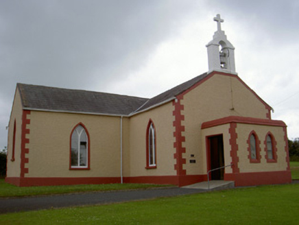 Catholic Church of Our Lady of the SnowsChurch/chapel · 1.1 mi
Explorer Tom Our Lady of the Snows church thinks modern buildings are just messy sketches waiting for a coat of paint. It’s sitting…
 Stonetown National SchoolSchool · 1.2 mi
Explorer Tom Stonetown National School in Newtown is doing what it does when nobody’s looking: polishing its boot scraper until it…
 Páirc Annaghminnon, Annaghminnon Rovers GAAGAA ground · 1.4 mi
 The Monks HouseChurch · 1.4 mi
Explorer Tom The Monks House is where a priest lost a bet and now has to sleep in the roof croft forever. It’s a single-celled…
 Church in RuinsChurch · 1.4 mi
Explorer Tom Church in Ruins had a prophecy that it would turn into gold if you whistled backwards, but nobody ever did. So it…
 Mapped graveyardGraveyard · 1.4 mi
Explorer Tom Mapped graveyard in County Louth is being picked on by the wind because it has nothing to hide and no secrets left to…
 Louth Village CemeteryCemetery · 1.5 mi
Explorer Tom Louth Village Cemetery in County Louth is currently being managed by a fox who thinks he owns the place and barks at…
More archaeology and monuments in County Louth · All of County Louth

What do you know about this place?Tap to add a comment or ask a question