
What is recorded here
Recorded construction date: 1860 - 1879. Current recorded use: Bank.
From the Northern Ireland Historic Buildings Record record HB10/02/016
The official record and map point do not grant access. Many historic buildings are privately owned; view them only from public ground unless the owner allows entry.
Places near here
Photo credits
- Kenneth Allen, Geograph · CC BY-SA 2.0
- Kenneth Allen, Wikimedia Commons · CC BY-SA 2.0
- National Inventory of Architectural Heritage
- Richard Webb, Geograph · CC BY-SA 2.0
- Photo courtesy PDPhoto.org, Wikimedia Commons · Public domain
- Willie Duffin, Geograph · CC BY-SA 2.0
 Historic Settlement: Castlederg, Derg Bridge, Castle-derrick or Churchtown in ChurchtownHistoric Settlement: Castlederg, Derg Bridge, Castle-derrick or Churchtown · 69 yd
 Castlederg BridgeBridge · 185 yd
 Fortified house & bawn: castlederg castle in CastlesessaghFortified House & Bawn: Castlederg Castle · 230 yd
 Birdstown Standing StonePublicly named standing stone · 3.1 mi
 Two standing stones in Crew LowerTwo Standing Stones · 3.3 mi
 Fearn HillMountain / peak · 3.5 mi
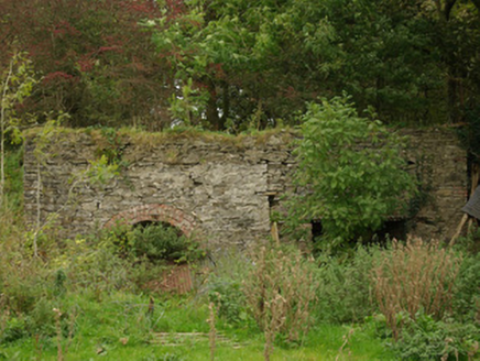 kiln4.0 mi
 Lismullyduff MountainMountain / peak · 6.6 mi
 Church; Graveyard; Carved Stone: Holywell Church in LackaghChurch · 7.1 mi
 Drumskinny Stone CircleHeritage attraction · 9.3 mi
 Gray PrinterHeritage attraction · 9.6 mi
 Drumboe WoodForest recreation place · 9.9 mi
More historic places in County Tyrone · All of County Tyrone
What do you know about this place?