
What is recorded here
Melted pots and broken glass still scatter the grass where Turbotstown Castle stood before the house rose above it. Richard Desse owned the land in 1641, yet no wall or gate remains for a visitor to touch. The two large limestone heads above the outbuilding doorways watch the yard like forgotten keepers, preserving the shape of a castle that disappeared beneath a newer home.
No surface remains visible of Turbotstown Castle which is depicted on the 1657 Down Survey map of Fore Barony (NLI, MS 723-4). The terrier of the 1657 Down Survey map of Mayne parish lists Richard Desse [Dease], an Irish papist as the owner of the lands and castle of Turbotstown in 1641 (ibid.). The precise location of this castle has not been identified. The location of Turbotstown House matches closely the location of the medieval castle on the 1657 Down Survey map suggesting that the present house was built either on the site of or close to the site of Turbotstown Castle. The castle is not depicted on any edition of the OS 6-inch map. The owner of Turbotstown House believes that part of the yard overlies the site of an earlier house. This earlier house could incorporate the site of Turbotstown Castle. High in the wall of the out offices in the yard immediately NW of Turbotstown House are two stone heads. The heads are placed over doorways and are quite large, carved in limestone with very sharp features, they appear sexless and appear to date from the 19th century. Turbotstown House described by the National Inventory of Architectural heritage as a 'detached three-bay two-storey house country house, built c.1810, with projecting single-bay entrance front with raised parapet over and a single-bay cut limestone tetrastyle Greek Ionic entrance porch the centre of the main façade (southeast)' (www.buildingsofireland.ie).
Compiled by: Frank Coyne & Caimin O'Brien
Date of upload: 2 December 2016
Turbotstown Castle was held by Richard Dease in 1657, as recorded in the Down Survey terrier of Mayne parish. It is remembered as an example of early modern Irish castle sites, now lost but documented in historical land surveys.
The monument record does not grant public access. Check the route and ask the landowner before entering private land.
- What survives
- Recorded monument
Places near here
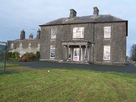 Turbotstown Housecountry house · 26 yd
 Partially hachuredFairy fort / earthen ringfort · 564 yd
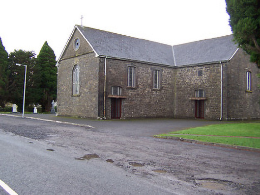 Catholic Church of the Immaculate Conceptionchurch/chapel · 677 yd
 IndicatedFairy fort / earthen ringfort · 994 yd
 TowerCastle, tower house · 1.4 mi
 European BeechEuropean Beech · 1.9 mi
 Pedunculate OakPedunculate Oak · 2.0 mi
 Rock of CurryCliff · 2.4 mi
 CastleCastle, motte · 2.5 mi
 Mullaghmeen ForestPicnic place · 4.8 mi
 Mullaghmeen White WalkWalking route · 4.8 mi
 Mullaghmeen Red WalkWalking route · 4.8 mi
Other information
Photo: Credit not shown in the picture search · Rights wording not checked; contact us if this picture should be removed