What is recorded here
On bluff, on N bank of River Blackwater, within gardens of Ileclash House. Circular mound (diam. 42m; H 4.6m) with flat top; steps ascend to top on E and W sides; sides inaccessible due to heavy ornamental planting. Hachured as stepped circular mound on 1905 OS 6-inch map.
From the National Monuments Service (Archaeological Survey of Ireland) record CO035-022
The monument record does not grant public access. Check the route and ask the landowner before entering private land.
- What survives
- Recorded monument
Places near here
 Ileclash HouseCountry house · 93 yd
 Licklash Castle (in Ruins)Castle, hall-house · 309 yd
 Old Railway ViaductViewpoint · 691 yd
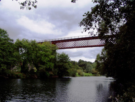 Carrigabrick BridgeViaduct · 694 ydCarrigabrick Castle (in Ruins)Castle, tower house · 709 ydEnclosure in Gearagh (condons and Clongibbon By.)Enclosure · 798 ydKent BridgeMemorial · 1.2 miTourist InformationVisitor information · 1.2 miGraveyard in FermoyGraveyard · 1.3 mi
 St Bernards WellHoly well · 1.5 miStrawhall WoodForest · 1.9 miBallybrack WoodForest · 2.0 mi
Pictures: National Inventory of Architectural Heritage; Mike Searle, Geograph · CC BY-SA 2.0; Hywel Williams, Geograph · Creative Commons Attribution-ShareAlike 2.0
More archaeology and monuments in County Cork · All of County Cork
What do you know about this place?