What is recorded here
From OpenStreetMap (© OpenStreetMap contributors) n3803607369
Places near here
Picture notes
- louise price, Wikimedia Commons · CC BY-SA 2.0
- National Inventory of Architectural Heritage
- louise price, Geograph · CC BY-SA 2.0
- Computer-made picture. It does not show this playground.
- Kenneth Allen, Geograph · CC BY-SA 2.0
 Burial GroundGraveyard · 1.8 mi
Explorer Tom Burial Ground in Kilrean Upper is stacked with layers of history that refuse to stay quiet. You’ve got 12th-century sandstone window heads and a cross-slab with swastika patterns sitting right next to modern graves. It’s a bit of a chaotic archaeological buffet, so keep your eyes peeled for the odd carvings.
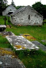 Inishkeel Graveyard near GlentiesGraveyard · 2.1 mi
Explorer Tom Inishkeel Graveyard near Glenties was rectangular in the older survey, but its south side sat on part of a roughly circular rise. Some of that rise lay beyond the west wall, about fifty metres across. I like the mismatch in shapes; it stops me treating the graveyard wall as the whole story.
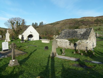 mausoleum2.1 mi
Explorer Tom Mausoleum in Drumnasillagh keeps its doors wide open, built c.1800 with no lock in sight. I reckon the MacLoone family just wanted to hear the wind sing through their living room.
 Binn BhánMountain / peak · 2.3 mi
Explorer Tom Binn Bhán is recorded as a mountain / peak in County Donegal. It is hilarious that the ground goes from boggy to suddenly hard right at the top, like nature hit the brakes. I bet my boots would be utterly confused.
 Myrtle CottageHouse · 2.3 mi
Explorer Tom Myrtle Cottage is actually named on a map from 1905! Most houses just blend into the background, but this one got its own little label. I bet the postman knew exactly which door to knock on without asking.
 Children's playground2.5 miComputer-made picture. It does not show this playground.
Explorer Tom Children's playground in County Donegal looks like it swallowed a unicorn and is still digesting the magic. The slide might transport you straight to the afterlife, but only on Tuesdays.
 St. Connell's Museum and Heritage CentreMuseum · 2.5 mi
Explorer Tom St. Connell's Museum and Heritage Centre lets me go from an old courtroom to the cells below, then into stories of the workhouse and Donegal railways. That is a lot of Glenties history packed into one building. I would leave the cells to the displays and keep my own visit on the friendly side of the door.
 GlentiesHostel · 2.5 mi
Explorer Tom Glenties Hostel is where you go to sleep in a bed that has seen too much. Bring an earplug, because snoring is guaranteed here.
 Kennedy's Bar and RestaurantRestaurant · 2.6 mi
Explorer Tom Kennedy's Bar and Restaurant is definitely hiding a secret menu involving only cabbage and regret. I bet the barman knows more about ghosts than he does about cocktails, so keep your ears peeled for whispers while you eat.
 Cloghmeen HillMountain / peak · 2.8 mi
Explorer Tom Cloghmeen Hill overlooks the 'deserted lands of Cronagass and Meentacreeghan'. I suspect those names are what happens when a mapmaker gets tired, spills ink, and just stops caring about pronunciation.
 Tullytrasna Standing StonePublicly named standing stone · 3.9 mi
Explorer Tom Tullytrasna Standing Stone is probably just one very tall rock that forgot to sit down. It looks like it’s straining its ears, trying to hear if anyone is calling for help from the other side of the hill.
 Disert GraveyardGraveyard · 4.1 mi
Explorer Tom Disert Graveyard is a D-shaped pocket inside two larger enclosures, with at least 34 low uninscribed grave markers noted across its centre. The account also records a striking custom: people took soil from near the altar because it was reputed to drive rats from houses. I'd keep that as a belief people held, not a promise from the place.
More mountains and hills in County Donegal · All of County Donegal

What do you know about this place?Tap to add a comment or ask a question