What is recorded here
Earliest record of town walls is murage grant of 1275 (O'Brien 1986, 372) which was renewed throughout late medieval period, but by 1631 walls were 'weak and ruinous' with 'no place to mount ordnance to defend the harbour' (Coleman 1906, 103); re-fortified in 1641-2 (Harbison 1977, 62). Pacata Hibernia map (Wain 1965, 36-7) shows walled town in two sections with 'basetown' (Irishtown) to S; thirteen towers are shown including South Gate, North Gate and Water Gate, with outworks outside North Gate; E line of wall ran along waterfront; walled harbour with two entrance towers outside WaterGate. To-day N and W ruins of town wall including three towers survive and have been described as 'possibly the best preserved medieval town walls in Ireland' (Harbison, ibid.; see plan Cockburn 1976, 14-5; see photos Buckley 1900, 158-8). Two semicircular and one circular tower (Banshee; Montmorenci and Half-Moon) stand at S end of W wall; this section (surviving for c. 450m) overlooks area of medieval town. W wall rebuilt in upper courses; square placements for wooden supports for wall walk; upper part of parapet rebuilt (Thomas 1992, 215). Line of N wall (c. 275m) descends steeply to E, with no towers surviving. Riverside wall apparently slighter (H c. 5m; Wth c. 0.6m) so could be late medieval (ibid). Stone arch (CO067-029012-), known as 'Watergate' or 'Cromwell's Arch' (Condon 1945, opp. 120) 'is seemingly a modern restoration of the antique "water gate" ' (Buckley ibid,160), leading from base town into former fortified harbour. See Excavation 1998, no. 89, no. 90 p. 23
The above description is derived from the published 'Archaeological Inventory of County Cork.
Earliest record of town walls is murage grant of 1275 (O'Brien 1986, 372) which was renewed throughout late medieval period, but by 1631 walls were 'weak and ruinous' with 'no place to mount ordnance to defend the harbour' (Coleman 1906, 103); re-fortified in 1641-2 (Harbison 1977, 62). Pacata Hibernia map (Wain 1965, 36-7) shows walled town in two sections with 'basetown' (Irishtown) to S; thirteen towers are…
From the National Monuments Service (Archaeological Survey of Ireland) record CO067-029002
The monument record does not grant public access. Check the route and ask the landowner before entering private land.
- What survives
- Recorded monument
Places near here
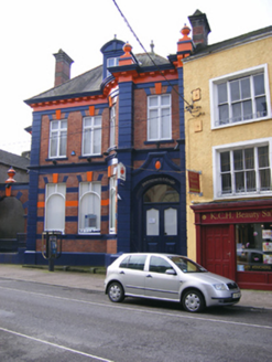 bank/financial institution31 yd
 Religious houseReligious house, Benedictine monks · 44 ydCrossCross, Market cross · 61 ydPriory Court Car ParkVisitor information · 82 ydEmmet PlaceMemorial · 99 ydYoughal Heritage WalkWalking route · 117 yd
 Tynte's CastleCastle · 195 yd
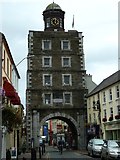 Clock TowerVisitor information · 277 yd
 Youghal Clock TowerHeritage attraction · 278 yd
 English holly299 yd
 European Yew308 yd
 Collegiate Church of Saint MaryHeritage attraction · 327 yd
Pictures: National Inventory of Architectural Heritage; JohnArmagh, Wikimedia Commons · Public domain; Jonjobaker, Wikimedia Commons · CC BY-SA 4.0; Robert Ashby, Geograph · CC BY-SA 2.0; Will McGoldrick, Wikimedia Commons · CC BY-SA 3.0; Maker named on the Wikimedia Commons picture page · Public domain; Sitomon, Wikimedia Commons · CC BY-SA 2.0; The Speckled Bird, Wikimedia Commons · CC BY-SA 4.0
More archaeology and monuments in County Cork · All of County Cork
What do you know about this place?