What is recorded here
Four towers stood beside Ardtully House before the grass claimed them, two near the main building and two on the riverbank. The western pair joined by a wall, forming a small enclosed world at the meeting of the Owbeg and Roughty Rivers. They vanished from sight but remain marked on the 1846 map, hidden beneath pasture rather than lost to time.
In level pasture within Ardtully Demesne, just W of the confluence of the Owbeg and Roughty Rivers. Two towers are indicated on the 1846 OS 6-inch map immediately W and c. 10m to the NE of Ardtully House, respectively. A further two towers are indicated and named 'Ruins of Towers' on the 1846 OS 6-inch map, on the riverbank c. 45m to the SSE and c. 45m S of the house, respectively; the two westernmost towers appear to be connected by a wall running NW-SE. The towers are not visible at ground level. See KE094-002002-.
Compiled by: Elizabeth Byrne, Ursula Egan and Sheila Ronan, Archaeological Survey Unit, University College, Cork.
Date of upload: 30 May 2011
The monument record does not grant public access. Check the route and ask the landowner before entering private land.
- What survives
- Recorded monument
Places near here
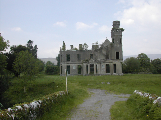 Ardtully Housecountry house · 17 yd
 Ardtully Ho.Country house · 20 yd
 European YewEuropean Yew · 32 yd
 Castle (Site of)Castle, unclassified · 51 yd
 Abbey Oriel (Site of)Ecclesiastical site · 90 yd
 SheepfoldsEnclosure · 1243 yd
 Great Southern & Western RailwayMemorial · 1.3 mi
 Battle of Callannbattle · 1.7 mi
 Kilgarvan Motor MuseumMuseum · 1.9 mi
 KnockbrackMountain / peak · 1.9 mi
 Shanagarry Castle (Site of)Castle, unclassified · 2.6 mi
 Knockbrack South TopMountain / peak · 2.7 mi