
What is recorded here
Abbey Oriel vanished before the 11th century, leaving behind only a curving depression in the pasture beside Ardtully Demesne. Stones taken from that forgotten church likely rose again inside Ardtully Castle, carrying sacred marrow into a later fortress. The abbey did not disappear so much as it changed shape, hiding its life inside the walls of the house that replaced it.
In pasture within Ardtully Demesne and c. 60m SW of Fussa Bridge. Listed by Gwynn and Hadcock (1970, 398) as an early monastic site, which probably ceased to exist before the 11th century. The only possible evident trace of the monastic site is a curving depression (Wth at top 5.2m, Wth at base 1.2m; D 0.3m) N-ESE, possibly the remains of a fosse. This feature is situated c. 75m NE of the NE corner of Ardtully House. According to Smith (1756, 46), stones from this site were used in the building of Ardtully Castle (KE094-002002-).
The above description is derived from the published 'Archaeological Inventory of County Kerry. Volume I: South-West Kerry' (Dublin: Stationery Office, 2009). In certain instances the entries have been revised and updated in the light of recent research.
Date of upload: 30 May 2011
The monument record does not grant public access. Check the route and ask the landowner before entering private land.
- What survives
- Recorded monument
Places near here
 Castle (Site of)Castle, unclassified · 80 yd
 Ardtully Ho.Country house · 89 yd
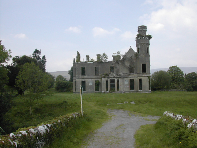 Ardtully Housecountry house · 90 yd
 European YewEuropean Yew · 120 yd
 SheepfoldsEnclosure · 1245 yd
 Glebe Ho.Ecclesiastical residence · 1451 yd
 Great Southern & Western RailwayMemorial · 1.3 mi
 Battle of Callannbattle · 1.6 mi
 Kilgarvan Motor MuseumMuseum · 1.8 mi
 KnockbrackMountain / peak · 1.9 mi
 Shanagarry Castle (Site of)Castle, unclassified · 2.6 mi
 Knockbrack South TopMountain / peak · 2.7 mi
Other information
Photo: Credit not shown in the picture search · Rights wording not checked; contact us if this picture should be removed