
What is recorded here
Ardtully castle stood in level pasture where the Owbeg and Roughty Rivers meet, lost after Colonel Donough MacFineen forfeited it and Cromwellian forces destroyed it. Four circular towers may have marked the place on later maps, but they vanished before the Baronial house that replaced them burned in 1921. Tradition claims stones from a nearby monastery were carried into the castle, giving the ruins a life older than their military fate.
In level pasture, just W of the confluence of the Owbeg and Roughty Rivers. In the 17th century, Colonel Donough MacFineen forfeited Ardtully and the castle here was later destroyed by Cromwellian forces (Orpen 1930, 149). Parts of this structure may be the four circular towers (KE094-002003-) depicted on the 1846 OS 6-inch map surrounding Ardtully House; there are now no visible remains of these towers. The site is now occupied by the ruin of a Baronial house built by Sir Richard Orpen in 1847 in place of the earlier house and burnt in 1921 (Bence-Jones 1978, 12; Bary 1994, 15).
There is a tradition that stones from a nearby monastery (KE094-002001-) were used in the building of the castle (ITA). This castle may be on or near the site of a 'castle'
which was built by Carew in 'Ardtuillighe' in 1215 (Ann. Inisf.).
The above description is derived from the published 'Archaeological Inventory of County Kerry. Volume I: South-West Kerry' (Dublin: Stationery Office, 2009). In certain instances the entries have been revised and updated in the light of recent research.
Date of upload: 30 May 2011
Ardtully Castle was built by the MacFineen family, who held it in the 17th century, and was later destroyed by Cromwellian forces after Colonel Donough MacFineen forfeited the estate. It is remembered for its connection to the Irish Confederate Wars and the subsequent land forfeitures under Oliver Cromwell's campaign.
The monument record does not grant public access. Check the route and ask the landowner before entering private land.
- What survives
- Recorded monument
Places near here
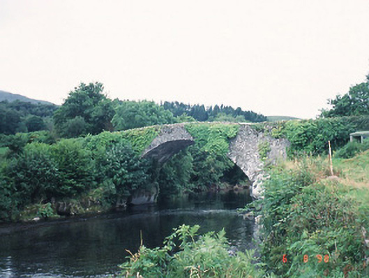 Ardtully Old Bridgebridge · 62 yd
 European YewEuropean Yew · 63 yd
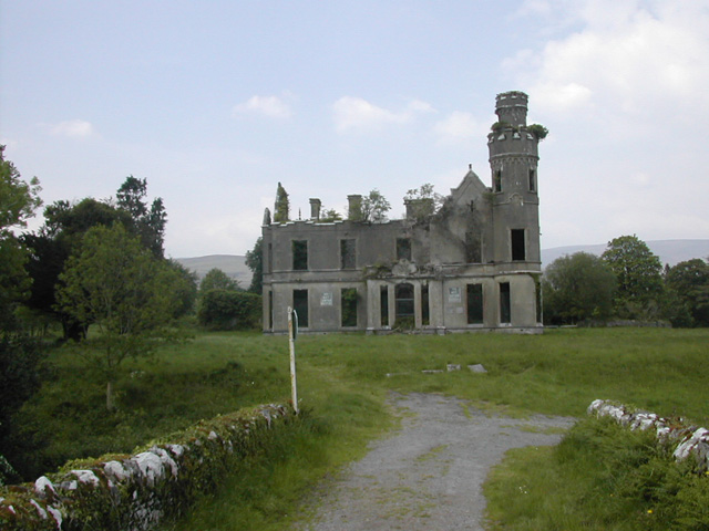 Ardtully Housecountry house · 66 yd
 Abbey Oriel (Site of)Ecclesiastical site · 80 yd
 SheepfoldsEnclosure · 1197 yd
 Great Southern & Western RailwayMemorial · 1.3 mi
 Battle of Callannbattle · 1.6 mi
 Kilgarvan Motor MuseumMuseum · 1.8 mi
 KnockbrackMountain / peak · 1.9 mi
 Shanagarry Castle (Site of)Castle, unclassified · 2.6 mi
 Knockbrack South TopMountain / peak · 2.7 mi
 Hidden Valley Pet FarmHeritage attraction · 3.2 mi
Other information
Photo: Credit not shown in the picture search · Rights wording not checked; contact us if this picture should be removed