
What is recorded here
From OpenStreetMap (© OpenStreetMap contributors) n332372649
Places near here
Photo credits
- Joe King, Wikimedia Commons · CC BY-SA 3.0
- Matthew Chadwick, Wikimedia Commons · CC BY-SA 2.0
- Pampuco, Wikimedia Commons · CC BY-SA 4.0
- Maker not stated on source page, uk.pinterest.com
- Maker not stated on source page, commons.wikimedia.org
- Colin Park, Geograph · CC BY-SA 2.0
- Maker not stated on source page, www.dreamstime.com
- Maker not stated on source page, en.wikipedia.org
- National Inventory of Architectural Heritage
- Pierre Terre, Geograph · CC BY-SA 2.0
 TonelageeMountain / peak · 1214 yd
Explorer Tom Tonelagee's Irish name means backside to the wind, which sounds like advice I have followed on every wet hill in…
 Glenmacnass WaterfallVisitor attraction · 1.3 mi
Explorer Tom Glenmacnass Waterfall is currently in a heated argument with the tree right next to it about who gets more attention…
 Wicklow GapMountain pass · 1.7 mi
Explorer Tom Wicklow Gap makes crossing mountains look easy because somebody laid a road through the argument. The R756 climbs to…
 Standing stone in Carrigeenduff,drummin (ballinacor North By.)Standing stone · 1.7 mi
Explorer Tom Standing stone in Carrigeenduff is irregular and pointed, sitting on a boundary where the ghost is too lazy to haunt it…
 Standing stone in Drummin (ballinacor North By.)Standing stone · 1.9 mi
Explorer Tom Standing stone in Drummin is making a New Year's resolution to stop slumping into that boggy mess. It's a tiny square…
 Scarr North-West TopMountain / peak · 1.9 mi
Explorer Tom Scarr North-West Top in County Wicklow has a curse that only affects people who don't wave on the way down, which is…
 Templefinan GraveyardGraveyard · 3.1 mi
Explorer Tom Templefinan Graveyard runs on a superstition that if you whistle, the stones will rearrange themselves to match your…
 Bullaun stone in CarrigeenshinnaghBullaun stone · 3.4 mi
Explorer Tom Bullaun stone in Carrigeenshinnagh has one circular basin on its highest point and an imaginary fan club that consists…
 Native Woodland Trust: Paddock Hill ReserveNature reserve · 3.8 mi
Explorer Tom Paddock Hill Reserve above Laragh is the sort of place that makes a young woodland seem older than its years, mainly…
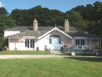 Lake Park HouseHouse · 4.3 mi
Explorer Tom Lake Park House in Carrigroe swears Queen Victoria stopped by for tea in 1845 and left her thimble behind. No one can…
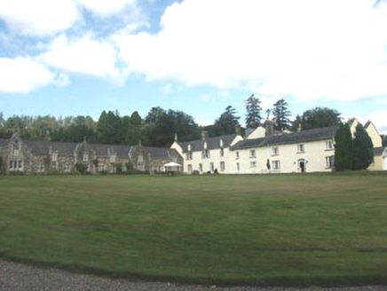 Glendalough HouseCountry house · 4.4 mi
Explorer Tom Glendalough House in Drummin lost its front wing in the seventies, and the whole parish argued about who was to blame…
 J.b. Malone MemorialMemorial · 5.9 mi
Explorer Tom J.B. Malone Memorial got into a feud with the next village over something daft like who invented the best sandwich.…
More mountains and hills in County Wicklow · All of County Wicklow

What do you know about this place?Tap to add a comment or ask a question