What is recorded here
From the Irish Caves Database, University of Bristol Spelæological Society record 1853
Places near here
Picture notes
- Computer-made picture. It does not show this monument.
- National Inventory of Architectural Heritage
- Computer-made picture. It does not show this playground.
- Computer-made picture. It does not show this walking route.
- Mike Searle, Wikimedia Commons · CC BY-SA 2.0
- Paul Woods, Wikimedia Commons · CC BY 2.0
- Computer-made picture. It does not show this mountain top.
- The Banner, Wikimedia Commons · CC BY-SA 3.0
 Fulacht fia in SranagalloonFulacht fia · 559 ydComputer-made picture
Explorer Tom Fulacht fia in Sranagalloon hosted a fake royal visit where the Queen was actually a goat in a wig. Nobody can disprove it because nobody was there. Practise your Irish on it, it won’t correct your pronunciation or judge you.
 Fairy fort / stone ringfort in SranagalloonFairy fort / stone ringfort · 690 ydComputer-made picture
Explorer Tom This final stone ringfort in Sranagalloon is still waiting for its story to be told, so we’ll just have to trust it’s well-preserved.
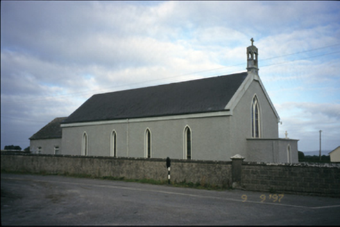 Saint Michael's Catholic ChurchChurch/chapel · 1.4 mi
Explorer Tom Saint Michael's Catholic Church in Creggaunycahill is an 1850 church with a carved limestone bellcote that looks like it’s been through the wringer. It’s got leaded glass windows and a flat-roofed porch, which is a bold architectural choice. Sit on a wall near it and pretend you're in a painting.
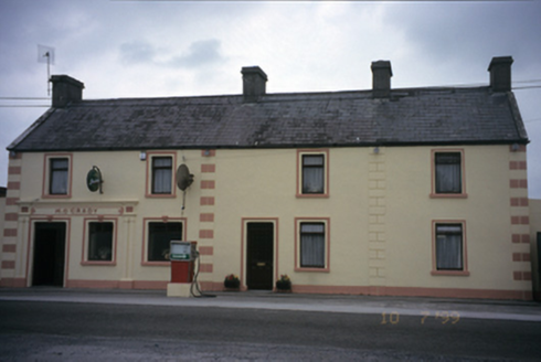 M. O'GradyHouse · 1.8 mi
Explorer Tom M. O'Grady in Carrowcraheen is a house that used to be a post office, which means it knows where all your letters went. Built around 1890, it’s now a pub, so the mail has been replaced by pints. Linger, it's not going anywhere and neither should you.
 Children's playground2.1 miComputer-made picture
Explorer Tom Another children's playground where the laughter of children echoes through the green space.
 Dromore Wood LoopWalking route · 3.9 miComputer-made picture
Explorer Tom Dromore Wood Loop in County Clare is all about the trees and quiet. Good for thinking, or just zoning out. Bring a book if you get bored!
 Dromore CastleCastle · 4.1 mi
Explorer Tom Dromore Castle sits by Dromore Lough, featuring a tall chimneystack and guard rooms, easily found near a large nature reserve.
Dromore Castle (in ruins)Castle, tower house · 4.1 miExplorer Tom Dromore Castle used to be on an island, which sounds like a very expensive holiday home. Teige built it, probably while arguing about who gets the best chair. Ten minutes here and you'll have a yarn for the pub that lasts all night.
 Mullagh MoreMountain / peak · 5.0 mi
Explorer Tom Mullagh More, a limestone hill in County Clare that's as hardy as the people who live there.
 Mullaghmore Red PathWalking route · 5.3 miComputer-made picture
Explorer Tom Mullaghmore Red Path in County Clare is red for a reason! Maybe it's spicy or dangerous. I'm guessing it's just a nice trail. Don't panic!
 KnockanesMountain / peak · 5.7 miComputer-made picture
Explorer Tom Oh, Knockanes! A rugged peak in County Clare that's as mysterious as the map says it is.
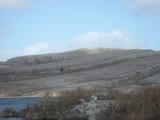 Burren National ParkNature reserve · 5.9 mi
Explorer Tom Burren National Park is a landscape like no other, with its rocky karst terrain stretching out under the wide, open sky of County Clare.
More caves in County Clare · All of County Clare

What do you know about this place?Tap to add a comment or ask a question